MapBusinessOnline newsletter – September 2013
Your Business Map is a regularly published newsletter designed to update and assist the users of MapBusinessOnline. We encourage the sharing of actual map success stories because it is you - the growing MBO user base - that is exposing the true power of business mapping. Please send us your stories and we will share them with others.
SpatialTEQ Releases MapBusinessOnline 4.0!
We are proud to announce release of the fourth version of MapBusinessonline.com. MBO 4.0 comes with a series of critical enhancements and brand new features developed at the request of our user base. Added functionality includes expanded territory management tools, new base map layer options, distance measurements, map printing and map display enhancements, extended map data & filtering options, and most popular drawing tools.
Expanded Territory Management Tools
- Territory managers may now highlight territory assignment intersections to identify overlapping sales responsibilities or coverage area holes.
- Territory Count feature reveals overlapping and unassigned zip codes, counties, or states for easy territory maintenance.
- Territory managers can now draw and label their own user defined territory segments with enhanced Draw Tools.
New Base Map Layer Options
- MapBusinessOnline 4.0 now offers National Geographic World Map and World Topographic Map views as an alternative to the MBO Streets map template layer.
- Satellite imagery views are now provided as an option to the Streets map layer.
- Zip code layer data options – users may now choose between Census ZCTA and USPS zip codes.
Distance Measurements
MapBusinessOnline 4.0 includes a basic measuring tool for quick point-to-point distance measurements. Examples of how users would apply the Measure Tool include determining territory widths, measuring the minimum distance between two retail locations, or viewing how far a new home is located from work.
Map Printing and Map Display Enhancements
Professional business users often use MapBusinessOnline to create presentation graphics or wall maps that inform constituents about business objectives or results.
- Large format printing through PDF file format now provides rectangle and circle print previews, defining the area of interest for printing.
- In addition to Map Legend control, MBO now provide s a flexible Map Title Bar that can be conveniently placed anywhere on the map to further define business maps.
New Map Data & Filtering Options
With MBO 4.0 users may now include web and email links with their imported business data and customer mapping software. Embedded links will display and open from the map. MBO 4.0 offers a wide array of data filters within the Data Window. With this release users may assign unique symbolization to filtered datasets and marketing lists for easy map identification. Users now have the ability to filter imported datasets, display just those results on the map.
Read full MapBusinessOnline 4.0 press release.
Easy Map Sharing
MapBusinessOnline makes sharing your business map’s with your constituents easy. Once you’ve saved your map view you can share it by clicking the Man Woman Icon on the tool bar – right next to the Print Icon. Here you will generate a URL you can then email or text to a map viewer. These URL strings are not searchable from search engines so as long as you control your link sharing, your maps are secure.
Remember, each licensed user of MapBusinessOnline includes up to 100 shared map views per month at no charge. That’s 1200 per year. Review your work flow to determine an estimate of the number of shared map views you’ll require. If you want to share many more maps or generate a lot of views we offer blocks of shared map views for an additional fee. Just Contact us for more information.
The Association of Specialty Cut Flowers embedded just such a map URL in their website:
http://www.ascfg.org/index.php?option=com_content&task=view&id=468&Itemid=469
MapBusinessOnline encourages this sort of free back linking for shared map views to limited viewers.
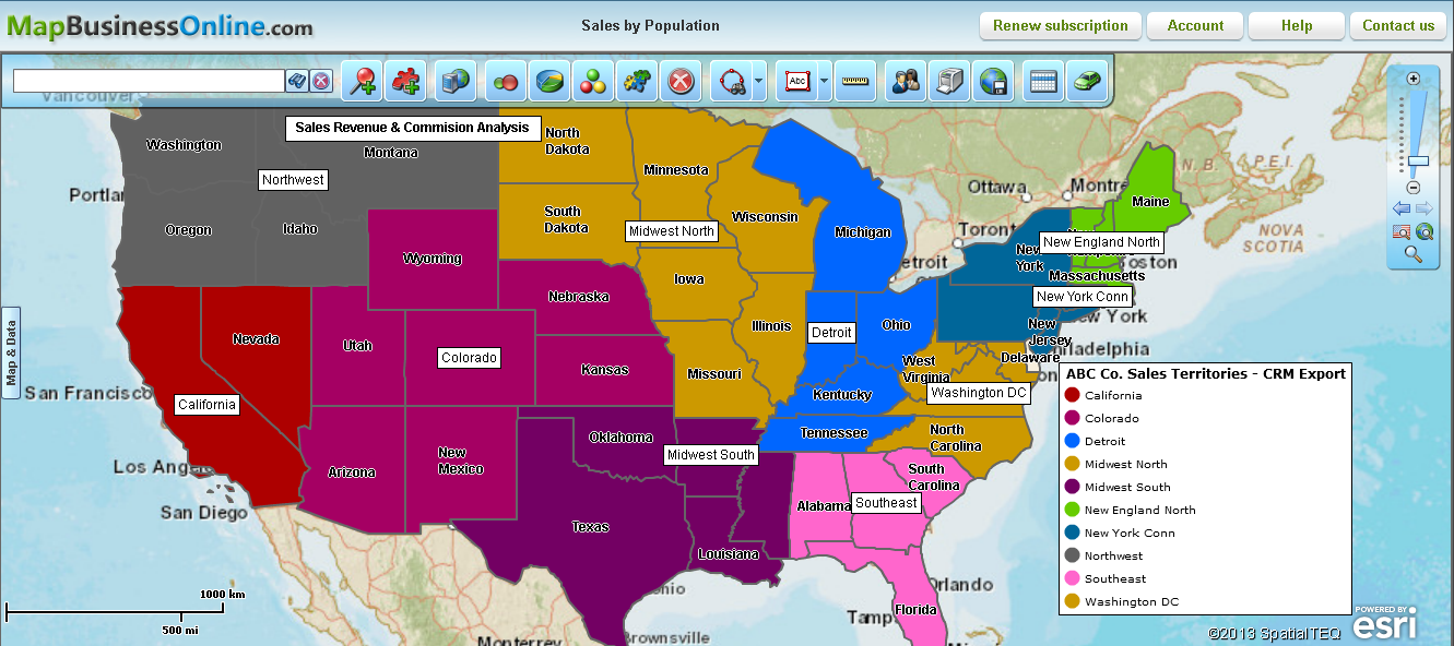
Advanced Territory Mapping
With the last two releases of MapBusinessOnline, sales territory mapping capabilities have taken a great leap forward. We’ve spoken with many MapBusinessOnline users who are creating and managing busy sales territories covering the entire USA.
Actual applications of new sales territory management functionality include:
- The ability to add demographic data to defined territory data sets by zip code, county, or state and export the results to CSV files for use in third party applications. MapBusinessOnline includes demographic data like population, median income and house hold data. This is a great sales planning tool for justifying territory changes for commission focused sales people. “It’s so nice to have that sales territory conversation with a map and a list of zip code data to refer to.”
- Querying sales and prospect data by territory area. Once territories are designed and named, each territory can be used to query an overall data set imported into MapBusinessOnline. Imagine you’ve imported the entire company’s prospect list and you just want to see those prospects that fall into Territory 5. In the Data Window simply select the overall prospect data set you’d like to query then click the Yellow Puzzle Piece Icon and select which territory you’d like to search within. Save the resultant file and export to CSV. Wicked neat!
- The creation of Master Territory regions that includes all individual sales territories. If you’ve created multiple territories across the country, you might want to run some queries that sum the totals of your customer, prospect or sales data across all sales territories.
- In the Map & Data Tab under Territory Options choose to let territories intersect.
- In the Data Window choose your Territory Base Map Layer (zip code, county or state).
- Hover over the Base Map Layer column header – click the Pencil Icon when it appears.
- Add “Territories” to the right side “Columns to show” list, and click Set Data Columns.
- Use the Filter tool to show zip codes (county or state) segments with quantities set at “Territories > 0”.
- Back on the Data Window select the “Create New or Edit Existing Territory” Icon – Blue Puzzle Piece with Red & Green Arrows.
- Choose “All geographies visible in Data Window”.
- Name your master territory and save it.
MapBusinessOnline Blog
Reach our Blog on latest news and business mapping insights.
New MapBusinessOnline Videos
And don’t forget to check out our new MapBusinessOnline YouTube Video.
Share Your Map Story
As always we are interested in ways to make MapBusinessOnline the best mapping software possible. Send us your business mapping software application examples. There are many map users who would like to learn about your application of web maps.


