Create a ZIP Code Map
ZIP code maps are powerful tools for businesses looking to visualize sales data, manage territories, or target specific areas for marketing campaigns. Whether you're working with a spreadsheet of sales data, territory assignments, or need to select ZIP codes within a certain radius or drive time from a central location, creating a ZIP code map can help you make data-driven decisions.
This article will walk you through the steps to create a ZIP code map using MapBusinessOnline and explore how these maps can benefit your business.
Import a ZIP Code List from a Spreadsheet
To get started, you’ll need a spreadsheet that includes a column of ZIP codes. Optionally, you can include additional data such as sales figures, customer counts, or territory assignments. This data will allow you to create a color-coded map that visually represents your business metrics.
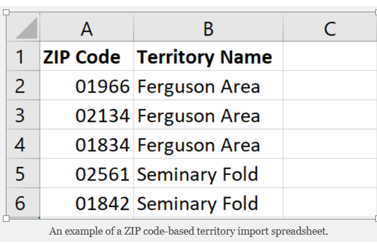
Steps to Import a ZIP Code Spreadsheet into MapBusinessOnline:
- Start the Create Territories wizard: Go to MapBusinessOnline app. Click the Territories button on the main toolbar.
- Upload Your Spreadsheet (Excel or CSV): On the first page of the wizard choose the Import territories option. Ensure your file has a column for ZIP codes and optionally a name of the territory if you want your ZIP codes grouped into territories.
- Setup Import Options: MapBusinessOnline will prompt you to map your spreadsheet columns to the appropriate data fields (e.g., ZIP code, territory name). Confirm the settings and proceed.
- Generate the ZIP Code Map: MapBusinessOnline will automatically generate a ZIP code map based on your data. You can customize the map further by adjusting colors, labels, and applying color-coding based on your sales data or other attributes.
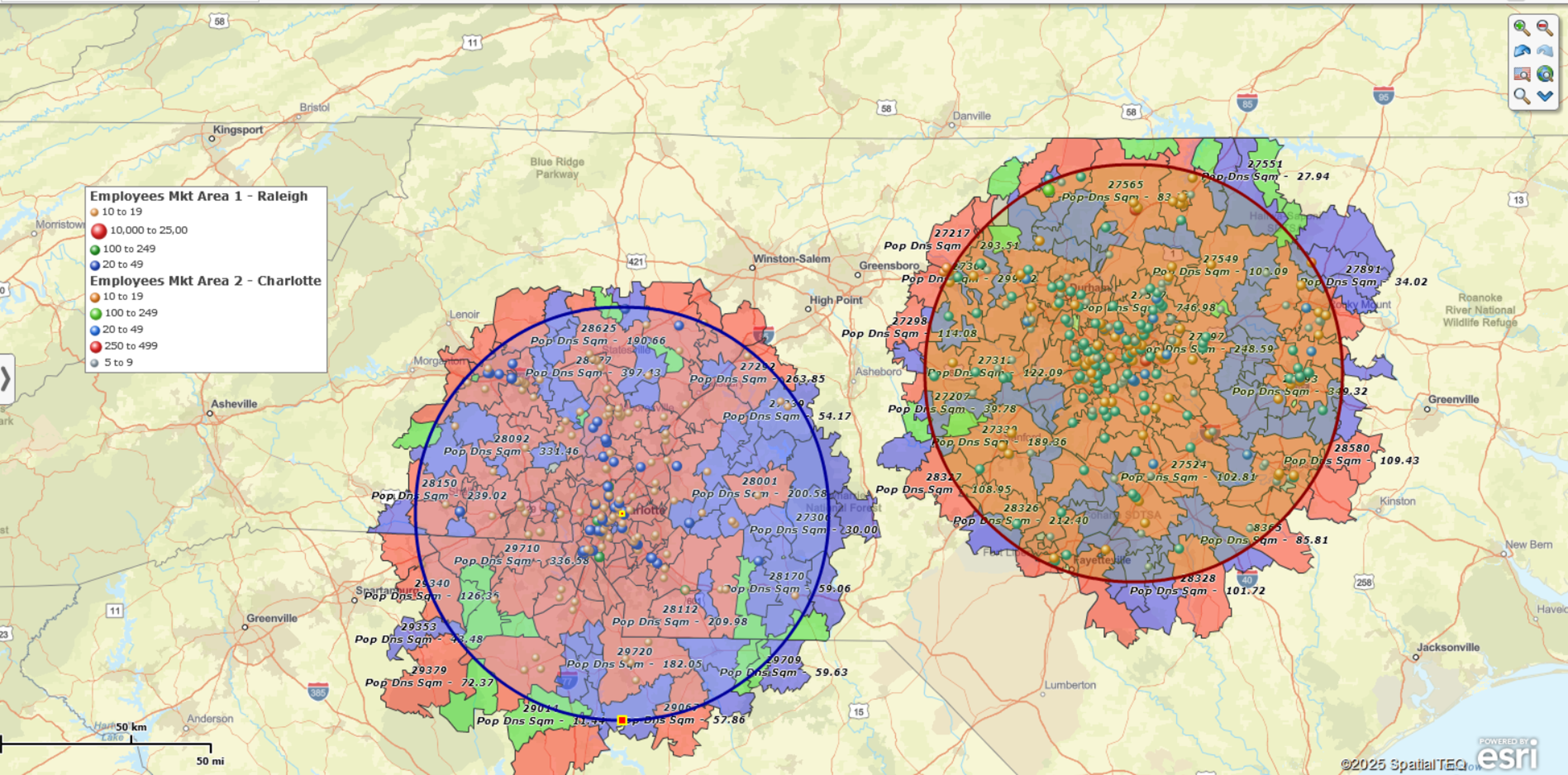
Select ZIP Codes by Radius or Drive-Time
Sometimes, you may need to focus on ZIP codes within a specific radius or drive-time from a central location, such as a store, office, or distribution center. This is particularly useful for planning delivery routes, targeting local marketing campaigns, or analyzing regional sales results.
Steps to Create a ZIP Code Map by Radius or Drive-Time:
- Select a Central Location: Use the search bar to find the central location (e.g., a city, address, or ZIP code) from which you will measure the radius or drive-time.
- Create a Circle or Drive-Time Polygon: Click Circle or Drive area in the plotted point’s menu. Enter the desired distance (e.g., 10 miles) or time extent (e.g., 30 minutes). Click Add to Map.
- Find ZIP Codes in the Area: Click the Search option in the circle’s or drive-time polygon’s menu and select the ZIP5 Code layer to create a new territory consisting of the ZIP codes within the area.
- Customize the ZIP Code Map: Adjust colors, labels, or add layers to make your map more informative and visually appealing.
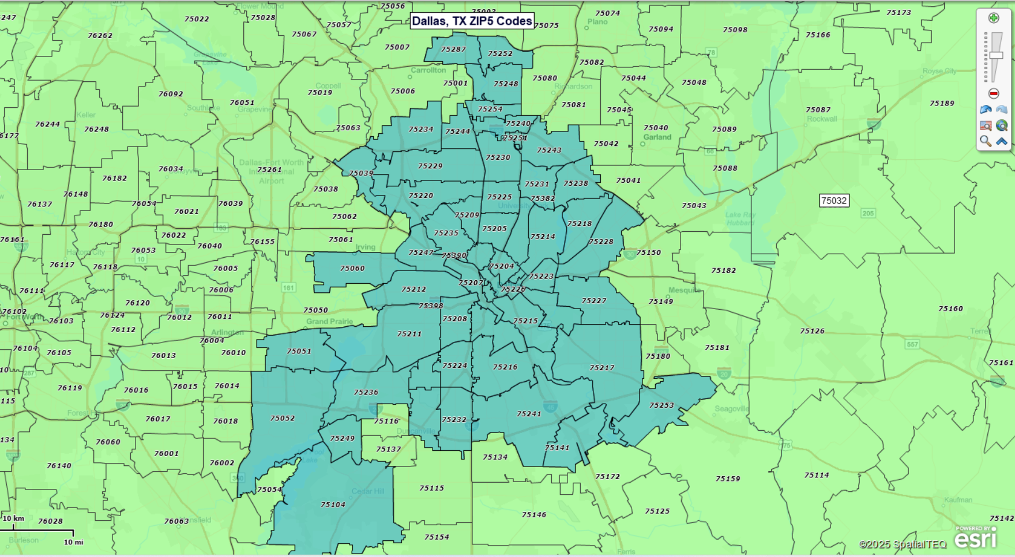
Boundary vs. Point ZIP Codes
When creating ZIP code maps, it’s important to understand the difference between boundary ZIP codes and point ZIP codes. Most ZIP codes are Boundary ZIP codes, the type of ZIP code we are all familiar with.
Boundary ZIP codes are associated with a USPS mail delivery area. Point ZIP codes represent buildings or complexes that accept bulk mail deliveries. Examples of Point ZIP codes include military installations, congregate homes, and hospitals.
MapBusinessOnline accounts for both Boundary and Point ZIP codes when analyzing imported business data.
What Can You Do with a ZIP Code Map?
ZIP code maps are versatile tools that can be used in various ways to support your business operations. Here are some key applications:
Visualize and Manage Territories by ZIP Code
Whether you’re managing sales territories, service areas, delivery zones, or franchise territories, a ZIP code map can help you clearly define and visualize these regions. You can create and edit territories by importing spreadsheets, or by visually selecting ZIP codes and assigning them to specific territories. MapBusinessOnline makes it easy to adjust boundaries, add new regions, or reassign areas as your business evolves.
Color-Code ZIP codes by Demographic or Imported Business Data
ZIP code maps allow you to overlay demographic data (e.g. population density, income levels), sales and other business data onto your map. This can help you identify high-performing areas, underserved markets, or regions with specific customer demographics. MapBusinessOnline provides a wide range of demographic data layers that you can apply to your map.
Overlay Customers or Other Business Locations
You can add layers to your map to show the locations of your customers, competitors, or other business locations. This can help identify patterns, such as clusters of customers in certain areas, or gaps in market coverage.
Export a list of ZIP Codes
Once you’ve created your map, you can export a list of ZIP codes by state, county, or within a specific radius or drive time for use in logistics, marketing or sales planning.
Analyze Distances between ZIP Code Datasets
MapBusinessOnline offers batch distance calculation tools that allow you to calculate distances between all points in one or two ZIP code datasets. These calculations are based on ZIP code centroids, so while they provide a reasonable estimate, they are not precise. This feature is useful for planning delivery routes, estimating travel times, or analyzing the proximity of customers to your business locations.
Customize Your ZIP Code Map
MapBusinessOnline lets you customize your map to suit your business needs. You can adjust the transparency of layers, add custom numeric fields or demographic data to ZIP code labels, change border colors, and more. This flexibility ensures that your map provides just the information your map audience needs.


