Franchise Planning Map
A few years ago, ABC HomeWork Help launched in the Northeast. The concept was to provide after school elementary and high school concept assistances for a fee. The franchise has grown in Northeast and now the organization wants to explore expansion into other areas.
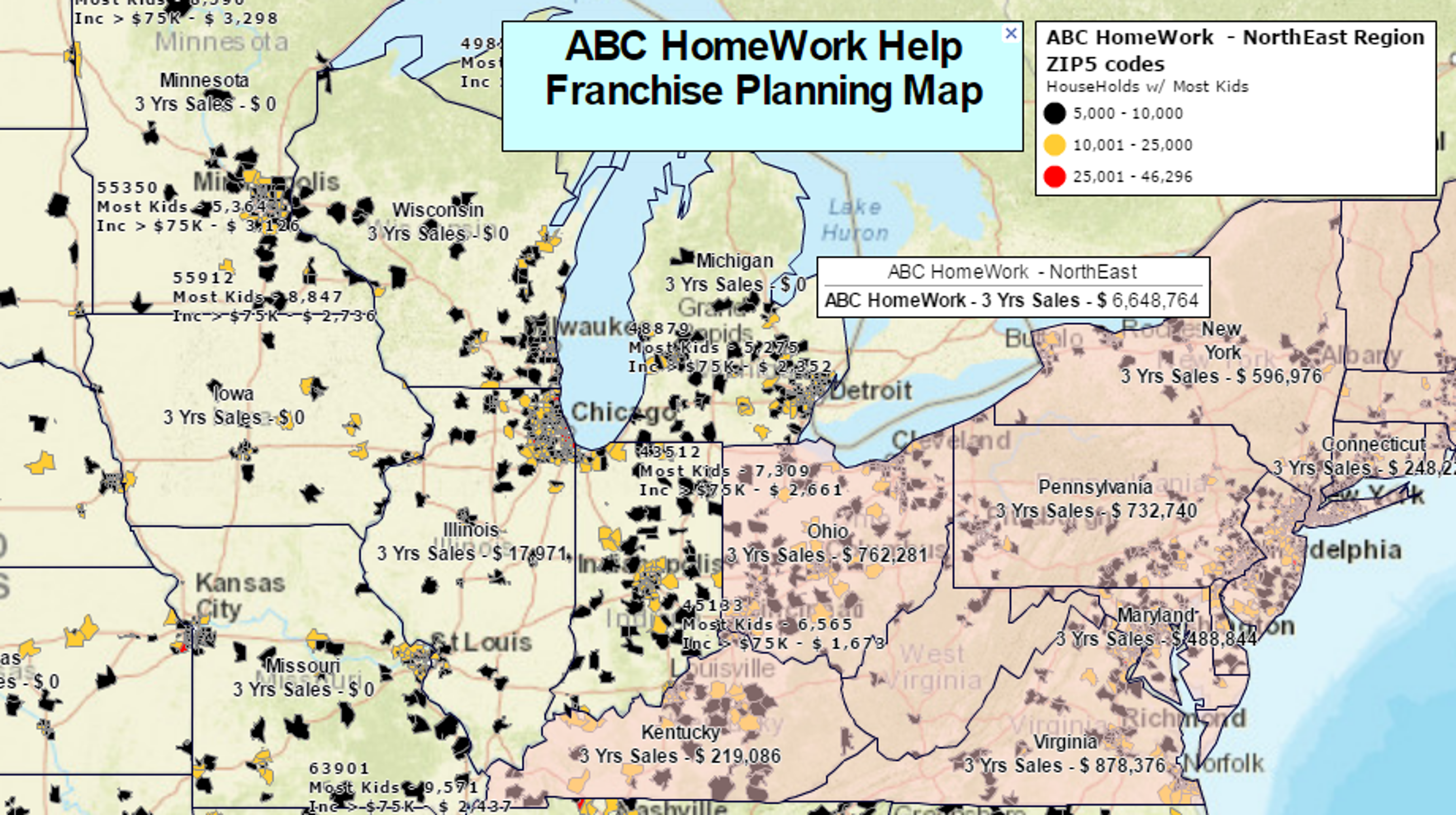
A planning map is created that reflects their current areas of business in the Northeast with three years of sales data compiled to show overall potential. ZIP codes across the nation have been color coded and labeled based on the learned franchise optimum demographics. Red ZIP codes with the most kids are the target.
Calculated Data Columns were applied in MapBusinessOnline to combine multiple levels of Household Income such that the ZIP codes with the greatest number of children were displayed in red. These “highest quantity of kids” ZIP codes will be the anchor ZIP codes for new territories. ZIP and State Labels have been appended to also display Calculated Data Columns combining multiple layers of highest household income from MapBusinessOnline demographic data, and to show 3 years of sales in the Northeast derived from imported business data.
Once the Red ZIP Code areas are analyzed and agreed upon a new map will be generated using an exported list of those Anchor ZIP codes to design territories for franchise, likely starting in Southern California.


