Filter map by state
This article describes how to filter map so it only shows selected states.
Related article: Create new map, save map, or open existing map.
In MapBusinessOnline you can filter map by one or more states. By default all states are visible on map.
Note: You can filter ZIP codes and counties map layers by state. But Streets map layer cannot be filtered by state.
- Normally you would filter map by states just after new fresh map is created. Read following article on how to create new map: Create new map, save map, or open existing map.
- Turn on ZIP codes, counties, or states on map. You may also want to turn off Streets, as that layer cannot be filtered.
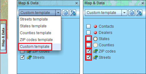
- Open Map & Data window if it is not already open. Click Map & Data tab centered on the left side of map.
- In the box at the top of Map & Data window select Custom map template. Usually it must be already selected.
- Check the box at the left of ZIP codes, counties, or states to make them visible. MapBusinessOnline may need to load data and then selected map layers will start to draw. Uncheck visibility box for Streets if you want to hide that layer from map.
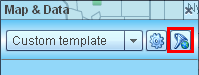
- Click filter icon on Map & Data window toolbar to start ‘Filter map’ dialog.
- Inside ‘Filter map’ dialog click ‘Clear all’ button to uncheck all states. Then check box at the left of desired states to add them to map.
Click Filter button.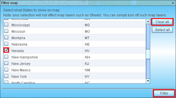
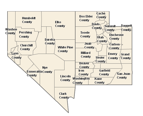
- Now you must have a map similar to one on the picture below.
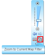
- Notice that once you have map filtered Zoom to World icon on Zoom control changes to Zoom to Current Map Filter.