
Business mapping software should allow map users to easily append their imported business data layers with additional and relevant data. This extra data can be demographic, geographic, or general business information that the user imports. In many cases, business mapping is really just a database management tool. As such, it should be easy to use and it should be exportable. It should also be affordable.
This week we received a customer email requesting assistance in applying Map Business Online. The Map Business Online user wanted to import a dataset of locations, append the data with multiple demographic data categories for the jurisdiction associated with each location (in this case Census tracts but it could be County, Zip code, etc.) They also wanted to assign a Census tract number ID to each location point. Not your grandmother’s business map application. But that depends on how old you are and she is. Never mind. Read on.
In Map Business Online both the full year subscriptions and team edition subscriptions users have access to the premium Market Analysis tool. This button is available on the toolbar, currently located eight buttons in from the left. It displays as a Target icon. ![]()
The first step in our user’s process is to import their business dataset. This is easily done and we have multiple videos dedicated to the plot data points process. The process places up to 100,000 location points on the map and assigns a circular colored symbol. Users are free to change the symbol or classify the data using color coding, symbol size and symbol options at their discretion.
Next, choose the Census Tract map layer. Census tracts are just one of the premium layer options available to full subscribers and located in the Premium Layer button – the World Icon just to the left of the Market Analysis Button. Choose the Census Tracts and click Add to Map. Once the Census Tracts are available as a layer in the map a user can hover over the Census Tract map layer in Map & Data, click the Edit gear to make that layer transparent or tweak other visual settings.
In general Map & Data provides controls for layer transparency, labeling, map layer look and feel. It also let’s you choose which layers to turn off and on. Map & Data includes tools for combining demographic layers, turning the legend box on and off, and for deleting your draw layer objects. Learn to love Map & Data.
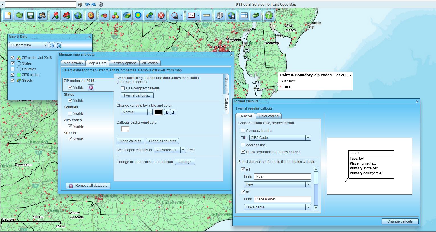
Map & Data opened up for label editing
Now click the Market Analysis button. Chose the lowest option, the fifth one down – the text says, “Add names and other information from map layer to dataset.” Click Next to assign your target imported data layer, the map Layer of interest (Census Tracts in this case.) Below the top section you will see where you can select information to append to your data – in this case Census Tracts and two Demographic Data categories. Once everything is selected click Next to process your work.
The result will add three columns to you imported Data Layer. All viewable in the Data Window. You can now export your data out of the application as a CSV file by clicking the Data Window toolbar’s far right Export Button. This will allow you to access and use your appended dataset outside of Map Business Online with the Demographic data included.
I liked this customer’s question. I found it blog worthy. Please let us know what questions you have.
Map Business Online – Easy, affordable, advanced, and we’ll help.
Find out why over 25,000 business users log into www.MapBusinessOnline.com
Contact: Geoffrey Ives geoffives@spatialteq.com (800) 425-9035, (207) 939-6866
MapPoint users – please consider www.MapBusinessOnline.com as your MapPoint Replacement.
Please read customer reviews or review us at Capterra, or at the Salesforce.com AppExchange.