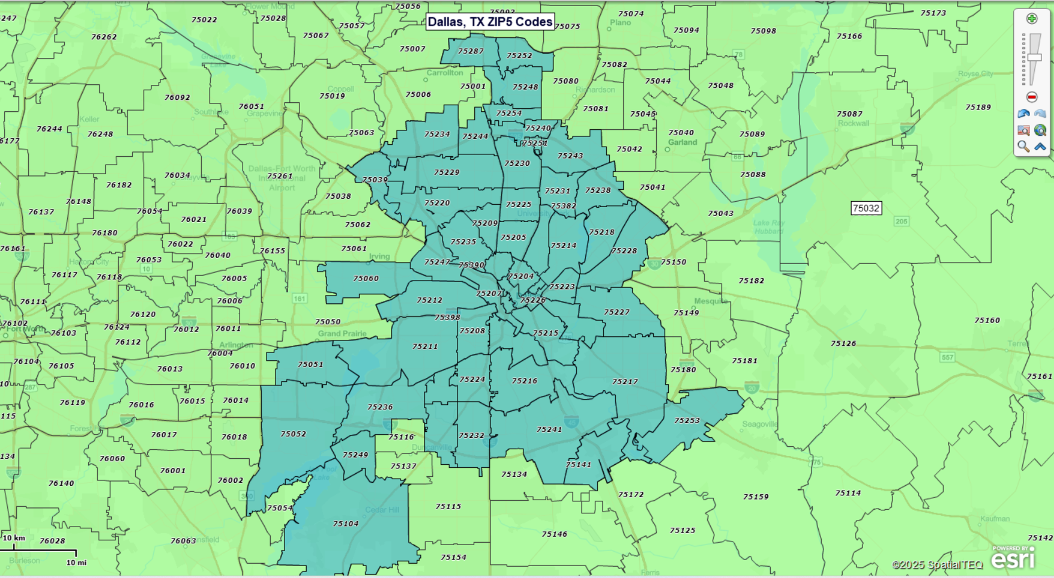
Dallas, Texas ZIP Code Map
Build Your Own Interactive ZIP Code Map
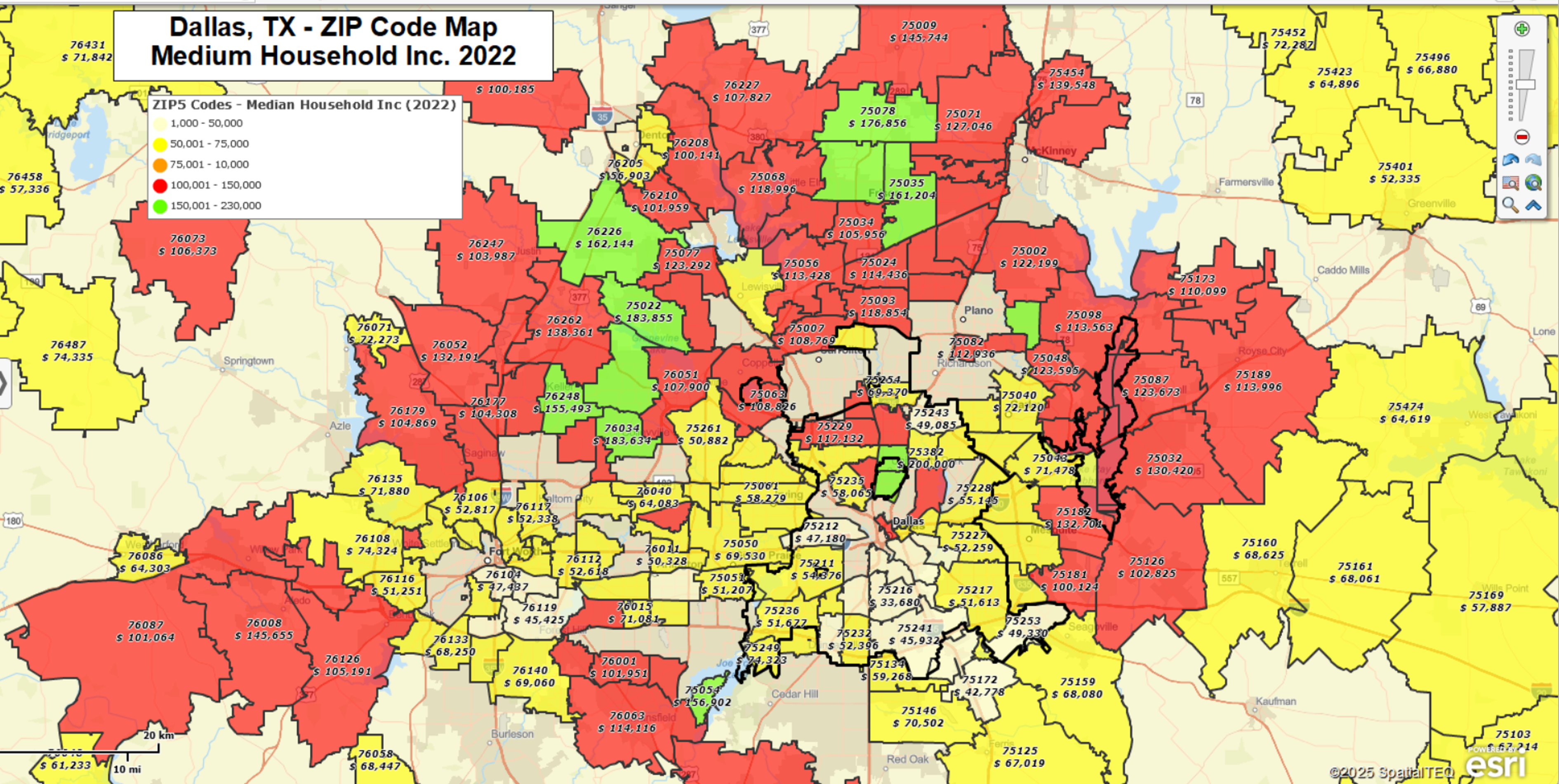
Map of Dallas ZIP5 Code Boundaries Color-coded by Median HH Income:
Demographic Data by ZIP Code
MapBusinessOnline provides two powerful mapping tools that work well together: ZIP code mapping and demographic data. Users easily create compelling ZIP code maps color-coded by included US Census Demographic data, such as recent population totals, median Household Income estimates, as well as ethnicity, education, and or consumer expenditure data. Learn more here.
Create Your Own ZIP Code Maps
MapBusinessOnline ZIP code mapping tools offer easy and affordable access to powerful mapping operations:
- Create ZIP-code-based sales, service, delivery, or franchise territories. Overlay customer and prospect locations. Control overlap.
- Plot and visualize your customers, market, and demographics by ZIP code areas.
- Create heat map visualizations of business activity by ZIP code.
- Search imported map data by radius, polygon, or drive time area.
- Export lists of ZIP codes along with Census data such as population and household income.
- Look up ZIP codes by city, county, or state.
- Plan logistics operations in targeted ZIP Codes, including optimized routing, origin-destination analysis, and drive time polygon creation.
- Find business listings in specific industries by ZIP code, radius, or state.
- Share interactive maps that display ZIP code areas.