MapBusinessOnline – Advanced Alternative to BatchGeo

MapBusinessOnline competes with several geospatial software companies one of which is BatchGeo who offers mapping services based on Google Maps. MapBusinessOnline.com (MBO), a web-based/cloud business mapping service, is the perfect, affordable alternative to BatchGeo or other web based mapping solutions that aren’t quite right for your business. These solutions may work well for basic map visualizations of several hundred up to several thousand of locations, but when it comes to territory design or more advanced market analysis tools, often required to make better business decisions, MapBusinessOnline is the most advanced tool in its class.
You’ll find MapBusinessOnline provides a complete set of business mapping features that may just be less expensive than some of our major competitors. Additionally our geocoding services are vast, fast, and affordable:
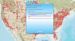
- Import and display up to 250,000 records in just a few minutes – fast & furious!
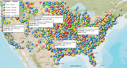
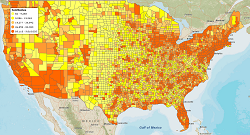
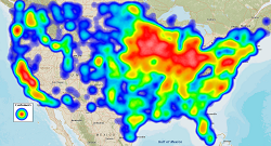
- Color-code and symbolize your business data – including heat maps!
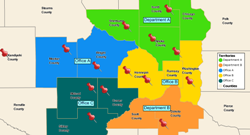
- Create and manage sales territories that drive accountability into your processes. Create territories defined by state, county, ZIP code and other geographies.
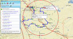
- Improve sales and delivery productivity with optimized route planning.
- Build demographic maps supporting your business expansion plans.
- Includes the most recent and accurate map data available!
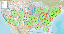
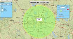
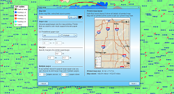
- Conduct drivetime analysis – search areas and business data by drivetime polygons.
- Print large format maps – up to 5’ by 5’!
- Import map presentation graphics into PowerPoint presentations.
- Easily share sales result by territory, state or district.
- Compare multiple datasets using our new Market Analysis tools.
- Access 5 & 3 digit zip codes, Census tracts, counties, states, city limits, & MSA’s.
- Color code your data by zip, county, city or state.
- Set up shared map editing teams – leverage your best minds!
- Access your cloud based maps from anywhere – just connect in to Internet!
- Supports address geocoding in the US, Canada and the UK.
- Integrates with QuickBooks, Act! and Salesforce.com.
- Unsurpassed technical support to help the greenest of users.
Still considering the switch from BatchGeo to MapBusinessOnline? Take 1-month free trial to try MapBusinessOnline first!
See MapBusinessOnline in Action
Request a demo
Learn How Our Customers are Succeeding with MapBusinessOnline
One of many international companies left hanging by Microsoft’s cancelation of MapPoint and turning to MapBusinessOnline for a MapPoint replacement. Multiple departments across the enterprise utilize business mapping for a variety of applications including claims management analysis, insurance related operational planning, and market analysis. An extremely detailed procurement and security review lead to a contract for MapBusinessOnline services. Corporate accounts use MBO for sales territory mapping, collaborative Team editing, and communicating with maps.
Top Ten Property & Casualty Insurer

"You guys are awesome! I used the MapBusinessOnline trial to get promoted to a sales position within my company. I showed them how I would work my territory with great MBO printed maps that showed projected sales dollars by account locations. I got the Job!"
Jeff Krieger
Territory Manager
Mizuno USA
Prison Fellowship — Prison Fellowship® trains and inspires churches and communities-inside and outside of prison-to support the restoration of those affected by incarceration. PFM uses MapBusinessOnline Team Edition to create a variety of maps that track the placement of constituents and describe the demographic background of placement areas for further study and understanding.
"We love MBO, especially the ability to share maps with non-license holders for viewing!"
Business Manager
Prison Fellowship

Popular MapBusinessOnline features
Build fast map visualizations of your business data
Design and visualize sales territories
Plan customers visits with optimized routing
Display business data against demographic maps
Perform Market Analysis for multiple sites
Draw custom graphics and annotate maps
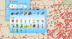
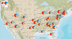
Visualize business data on map with various symbols
Illustrate business data on map with charts
Emphasize customers density with heat maps
Print large format map views
Share business maps