Print Large Format Map Documents

Business mapping software users often communicate with maps. And sometimes a really big printable map communicates the big picture most effectively. MapBusinessOnline includes the ability to save your map view in a PDF format to print large format wall maps.
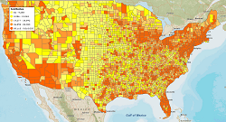
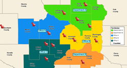
Typical uses of large format wall maps are call center environments that want to show field sales rep locations or sales activity across the USA; public safety emergency processes like missing persons search results or emergency resource locations; or natural resource planning operations describing energy resources over a large area.
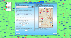
MapBusinessOnline business mapping software provides a flexible method of saving your large map view to a PDF. Choose between a what-you-see-is-what-you-get print preview or a print based on a hand drawn rectangle preview. Either way, you can easily establish just the right perspective for your target map area before you commit to a plotter print.
Take your finished PDF file to a graphics specialist, your plotter department or a FedEx Office shop to get your final map for hanging.
Print large format maps. Export large printable maps in Adobe® PDF format. No need for expensive equipment. Print large maps on multiple pages with your home or office printer. Print compelling wall maps up to 5 feet x 5 feet in size.
- Create business maps using your imported business data, Census demographic data, or 3rd party business data.
- Symbolize and color-code your map data as required.
- Choose the zoom level that sets the appropriate level of details for printed map.
- Choose the map size that establishes a bounding regional rectangle in portrait or landscape print view and includes your target business data.
- Choose “Save Map as PDF” print option. Select from paper preferences, adjust margins, and choose plotter or multi-page printing options.
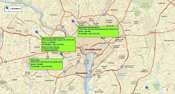
Print Large Format Maps to show Customers, Sales Progress, Market areas, or Territory Assignments.
Start using MapBusinessOnline with 1-month no-obligations FREE trial today!
See MapBusinessOnline in Action
Request a demo
Learn How Our Customers are Succeeding with MapBusinessOnline
"This software is a game changer for me in the workplace. Easy to use tools and a fast system to do the job efficiently and effectively every time. I’ve been able to build more territories with confidence, bringing my team more growth opportunities for 2019"
Daina C.
Franchise Development Manager
Amada Franchise, Inc.

"MapBusinessOnline Business Listings has been my go-to platform for the preliminary work necessary to develop growth strategies in the Restaurant Industry. I’ve found this platform to be intuitive, easy to navigate, and the data plentiful. Whether you are looking to expand using an adjacency strategy or make a large geographical leap, I’d suggest you start with MapBusinessOnline Business Listings."
Paul G. Tuennerman
Executive Vice-President
Sticky’s Holdings, LLC
"MapBusinessOnline one of the most powerful tools I have as a Regional Channel Manager. It’s a difficult task to visually represent the vast amount of data that I have to present to my customers and team members. MBO makes it easy to represent, configure, and manipulate the data on to an effective map. A picture is worth a thousand words, and MBO allows me to create a perfect picture."
Ed Ku
Regional Channel Manager
ABB
Popular MapBusinessOnline features
Print large format map views
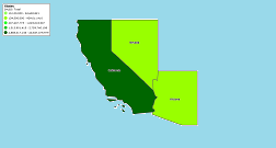
Create state or regional maps
Quickly build map visualizations of your business data
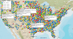
Differentiate business data points on map with symbols
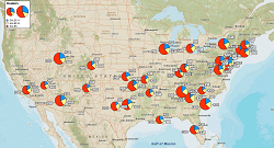
Illustrate sales data on maps with pie charts
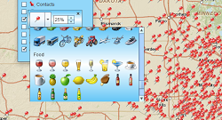
Identify your business data using flexible labels
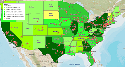
Color code maps by ZIP code, county, or state
Design and visualize sales territories
Display business data against demographic maps