U.S. Postal Service Point ZIP Code map
This map displays all USPS ZIP codes of both boundary and point ZIP code types.
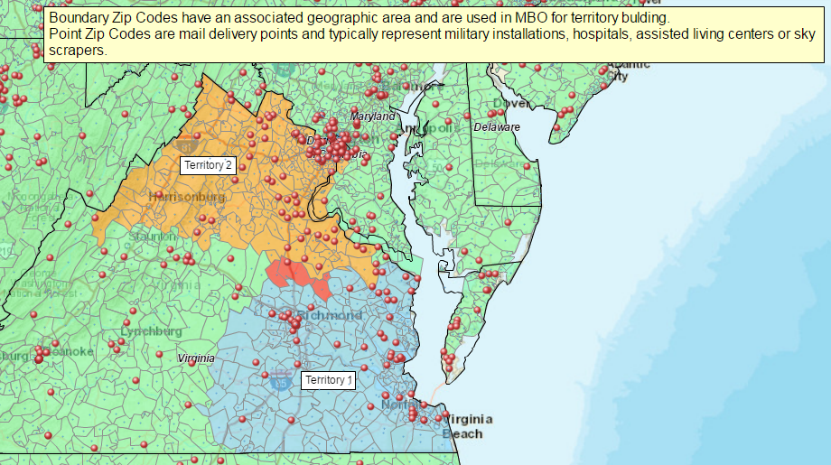
- Boundary ZIP codes have a geographic area associated with them. They are the usual ZIP code we’ve all come to know.
- Point ZIP codes represent bulk mail delivery points for large facilities like assisted living centers, military installations, hospitals, and schools.
This map shows several territories created in Virginia. We’ve added the total USPS 2016 ZIP code dataset to the map as points. This layer is available in the MBO Public Data file in the Plot Data dialog. The boundary ZIP points are extremely small blue dots, and point ZIP codes are the red dots. You’ll find about 6,000 point ZIP codes vs. roughly 35,000 boundary ZIP codes across the USA.
In the Data Window view, the territories shown here have the ZIP code types added to the associated data analysis. Users can filter for point ZIP codes and boundary ZIP codes, for individual territories or across the entire USA ZIP code layer and export the list.


