Select type of ZIP code layer
This article explains how to switch between various types of ZIP code layer: U.S. Census, USPS (U.S. Postal Service), and USPS with fillers ZIP codes.
MapBusinessOnline provides access to both U.S. Census ZIP Code Tabulation Areas (ZCTA) and U.S. Postal Service ZIP codes. ZCTA boundaries change quite rarely (about once in 10 years) but U.S. Census updates demographic data annually. On the other hand ZIP code boundaries change every quarter and demographic data supplied by U.S. Census is extrapolated from ZCTA to ZIP code boundaries. Depending on your business needs and internal processes you may choose to use ZCTA or ZIP code boundaries in your territory design project.
There are no ZIP code boundaries defined for unpopulated areas of United States. That’s why if you use USPS ZIP code layer you will see some empty areas on map. To cover these areas with a boundary use USPS ZIP codes with fillers option
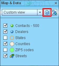
- Click gear icon on Map & Data window toolbar to start ‘Manage map and data’ dialog.
- Inside ‘Manage map and data’ dialog select ZIP codes page.
At the top of the page you can see what type of ZIP codes are currently on map. At the same time selection in the list at the mid of the page shows what type of ZIP codes are set for your MapBusinessOnline account and will be used for new maps.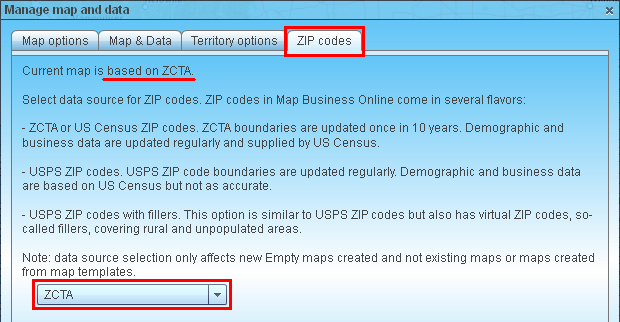
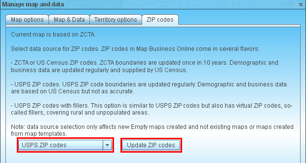
- Select alternative type of ZIP codes in the list in ‘Manage map and data’ dialog. You will see ‘Update ZIP codes’ button showing up. Click it to change ZIP codes type used by default for your account.
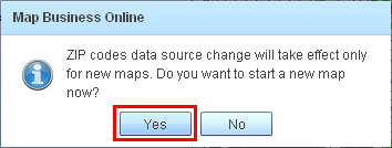
- MapBusinessOnline will prompt you to start new map. Click ‘Yes’ to create new map with selected type of ZIP codes.