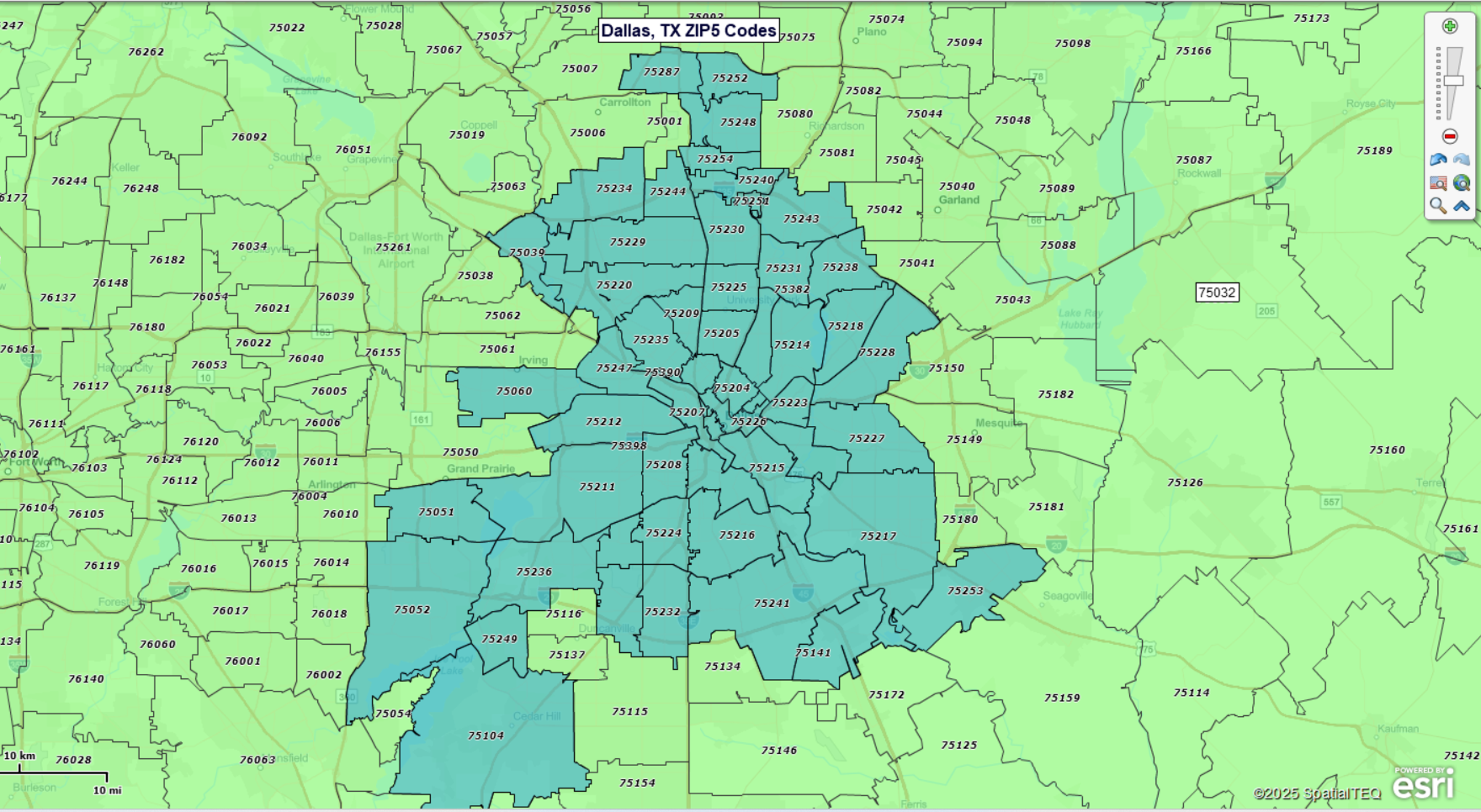
Dallas ZIP Code Map
Open & Download the Map
-
Open Dallas ZIP map in the Interactive Viewer (quick free install required the first time) — explore the Dallas ZIP Code boundary map interactively. Pan/zoom to your area, search ZIP Codes by number or name, or use circle or polygon search tools.
-
Download high-resolution Dallas ZIP map — save a detailed static image for presentations, reports, or planning.
Explore ZIP Codes in the Viewer
With the free MapBusinessOnline Viewer you can:
-
Search any Dallas ZIP Code and locate it instantly.
-
Find ZIPs within a radius of Downtown Dallas (enter miles and copy the list).
-
Find ZIPs within a custom area (draw a polygon to capture ZIPs).
-
Calculate a route and estimate driving distance between locations.
Popular ZIP Codes in Dallas
Here are some of the most locally recognized ZIP Codes in Dallas — each tied to a distinctive neighborhood. Explore the interactive map above for the full set of over 100 ZIP Codes.
75201 – Downtown / Arts District (cultural and commercial core)
75202 – Dealey Plaza area (historic downtown East)
75204 – Uptown / Deep Ellum (restaurants, nightlife, galleries)
75205 – Highland Park (luxury homes, shopping, schools)
75206 – East Dallas / Lakewood (near White Rock Lake)
75208 – Bishop Arts District (bohemian shops & eateries)
75214 – Forest Hills / Casa Linda (parks and historic homes)
75223 – Fair Park / South Dallas (State Fair of Texas grounds)
Frequently Asked Questions
How many ZIP Codes are there in Dallas, TX?
Dallas spans over 100 ZIP Codes, depending on whether you include surrounding neighborhoods and PO Boxes. You can explore them all using the interactive map above.
How can I copy the full list of Dallas ZIP Codes?
Use the interactive viewer to select ZIPs visually, then export the complete list in one click — fast and accurate.
Why do some ZIP Codes cross city or county lines?
ZIP Codes follow postal delivery routes, not administrative borders. That’s why some ZIP areas extend beyond city or county boundaries.
Can I use the map to build custom ZIP-based maps?
Yes, you can register for a free trial of MapBusinessOnline — then create custom ZIP maps, add demographic layers, build sales territories, load your business data, and export your results.
What ZIP Code data is used on this page?
The map and ZIP listings are based on ZIP5 boundaries as defined by USPS delivery routes (commercial-grade accuracy). Learn more in our article on Understanding ZIP Codes for Business Mapping Use.
Build Your Own ZIP Code Map
Want to build and save your own ZIP map with more options? Register for a free trial account. With MapBusinessOnline you can:
- Create ZIP-code-based sales, service, delivery, or franchise territories. Overlay customer and prospect locations. Control overlap.
- Plot and visualize your customers, market, and demographics by ZIP code areas.
- Create heat map visualizations of business activity by ZIP code.
- Search imported map data by radius, polygon, or drive time area.
- Export lists of ZIP codes along with Census data such as population and household income.
- Look up ZIP codes by city, county, or state.
- Plan logistics operations in targeted ZIP Codes, including optimized routing, origin-destination analysis, and drive time polygon creation.
- Find business listings in specific industries by ZIP code, radius, or state.
- Share interactive maps that display ZIP code areas.


