New York City ZIP Code Map

Open & Download the Map
-
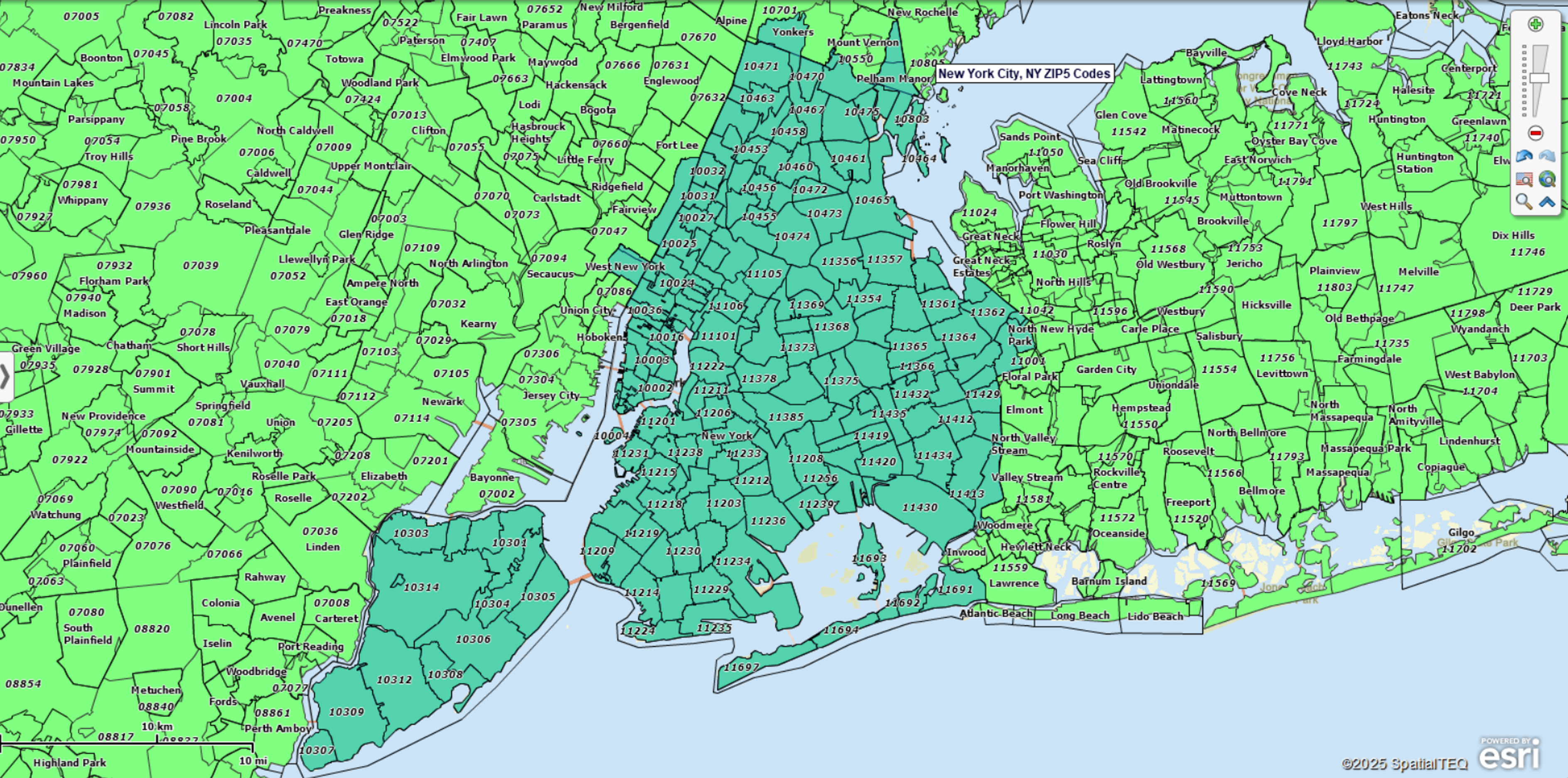
Open New York City ZIP map in the Interactive Viewer (quick free install required the first time) — explore ZIP Code boundaries across Manhattan, Brooklyn, Queens, the Bronx, and Staten Island. Pan, zoom, and search by ZIP Code, or use tools to find ZIPs within a radius or custom area.
-
Download high-resolution New York City ZIP map — save a detailed static image for presentations, reports, or planning.
Explore ZIP Codes in the Interactive Map (NYC)
With the free Interactive Map, you can:
-
Search any NYC ZIP Code by number or address and see it located on the map.
-
Find ZIPs within a radius of any point (e.g., Times Square), then export the list.
-
Select ZIPs in a custom area by drawing a polygon and exporting the list.
-
Plan routes between locations and view distance and estimated driving time (add start/end, optional stops, then print/share directions).
-
Download a high-resolution map image for reports and presentations.
Popular ZIP Codes in New York City
Here are some of the most iconic ZIP Codes in New York City, each associated with a neighborhood that resonates with locals and visitors alike. Use the interactive map above to explore the complete set of more than 170 ZIP Codes.
10001 – Midtown Manhattan (Penn Station & Hudson Yards)
10013 – Lower Manhattan (Tribeca and Chinatown)
10023 – Upper West Side (near Lincoln Center)
10451 – South Bronx (home to Yankee Stadium)
11201 – Brooklyn Heights and Downtown Brooklyn
11211 – Williamsburg (Brooklyn’s arts and nightlife hub)
11368 – Corona / Flushing Meadows in Queens (Citi Field area)
11694 – Rockaway Beach (Queens waterfront community)
Frequently Asked Questions
How many ZIP Codes are in New York City?
There are over 170 ZIP Codes across the five boroughs.
Which borough has the most ZIP Codes?
Queens contains the largest number, reflecting its size and population.
Why do some ZIP Codes cross borough or county lines?
ZIP Codes follow USPS delivery routes, not political boundaries.
How can I copy or export all NYC ZIP Codes?
Use the Interactive Viewer to select ZIPs and export the full list.
Can I build my own ZIP-based maps?
Yes. Register for a free trial of MapBusinessOnline to create custom ZIP maps, add demographics, build sales territories, and overlay your business data.
What ZIP Code data is used on this page?
The map and ZIP listings are based on ZIP5 boundaries reflecting USPS delivery areas (commercial-grade data source). Learn more in our article on Understanding ZIP Codes for Business Mapping Use.
Build Your Own ZIP Code Map
Want to build and save your own ZIP map with more options? Register for a free trial account. With MapBusinessOnline you can:
- Create ZIP-code-based sales, service, delivery, or franchise territories. Overlay customer and prospect locations. Control overlap.
- Plot and visualize your customers, market, and demographics by ZIP code areas.
- Create heat map visualizations of business activity by ZIP code.
- Search imported map data by radius, polygon, or drive time area.
- Export lists of ZIP codes along with Census data such as population and household income.
- Look up ZIP codes by city, county, or state.
- Plan logistics operations in targeted ZIP Codes, including optimized routing, origin-destination analysis, and drive time polygon creation.
- Find business listings in specific industries by ZIP code, radius, or state.
- Share interactive maps that display ZIP code areas.


