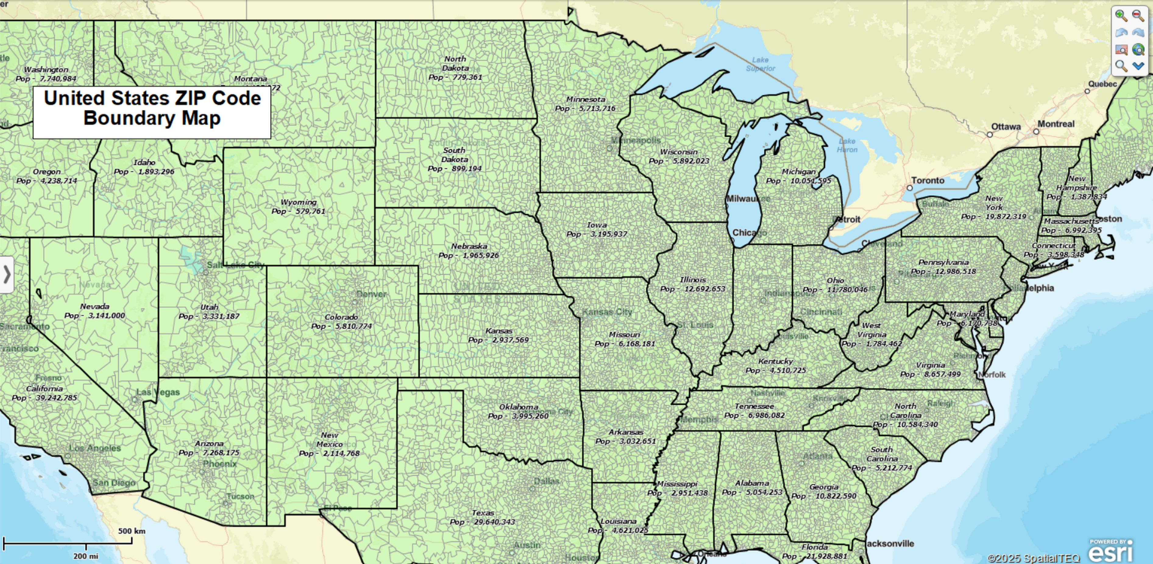
ZIP Code Boundary Map

Open & Download the Map
Open this ZIP Code Map in the Interactive Viewer (quick free install required the first time) - explore the full U.S. ZIP Code boundary map interactively. Pan and zoom to your region of interest, search ZIP Codes by number or name, or use circle or polygon search tools.
Download high-resolution U.S. ZIP Code Map - save a detailed static image of the ZIP Code boundaries for use in presentations, reports, or research projects.
Explore ZIP Codes in the Viewer
With the free MapBusinessOnline Viewer you can:
- Search any ZIP Code and have it located on the map.
- Find ZIPs within a radius. Draw a circle around a point — such as a store, facility, or city — and view all ZIPs inside the chosen distance.
- Find ZIPs within a polygon. Outline a custom area and capture every ZIP Code within it.
- Calculate a route and estimate driving distance between locations with the routing tool.
ZIP Codes vs. ZCTAs
This map shows commercial-grade ZIP Code boundaries aligned with USPS delivery areas. These are the official postal delivery areas used for mail, business planning, and territory design.
ZCTAs (ZIP Code Tabulation Areas) are Census Bureau approximations created for demographic reporting. They are useful for population statistics but don’t always match USPS delivery areas.
For business and delivery planning, MapBusinessOnline uses ZIP5 boundaries. Learn more in Understanding ZIP Codes for Business Mapping Use.
Beyond the Basics (in the full MapBusinessOnline app)
The Viewer is ideal for quick lookups. For deeper analysis, the full MapBusinessOnline app lets you:
- Define delivery, franchise, sales, service territories that help manage and analyze business activities.
- Access demographic data by ZIP code – Color-code ZIP code areas and download demographic information.
- Generate color-coded ZIP code maps of imported customer and competitor location data.
- Create market analysis and sales potential maps by overlaying ZIP code with numeric business data, demographic data, and other location-based datasets.
- Develop efficient, optimized vehicle routes for deliveries, sales routes, or field staff management.
- Create heat map data visualizations that display the intensity of business activity by point or ZIP code area.
In the full app, you can plot up to 250,000 locations, build up to 1500 territories, access 22M+ business listings and the library of demographic data, and share maps securely with your team.
Try It Yourself
Want to build and save your own ZIP Code map with demographics, territories, and your business data?


