MapBusinessOnline newsletter – August 2018
The ZIP Code Map
ZIP codes are the most popular administrative district layer applied in business mapping. Map users have choices. They could use states, counties or Census Tracts but they choose ZIP codes most often. There are many reasons for this and some of them are discussed in the recent blog post. But perhaps the biggest reason is that ZIP codes are kind of like our back yard. We're comfortable with the ZIP code as a unit of geography. In many cases it's where we roam most often in our day-to-day lives. It's where we live and eat and play. The map user's local ZIP code is where they walk their dog.
So when people start thinking about demographics and business areas, they most often think ZIP codes and build a ZIP code map.
Read more about the lowly ZIP code map
MBO's New Congressional District Layer
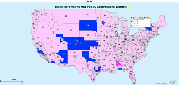
In June MapBusinessOnline was enhanced to include congressional districts. Here's a map using congressional districts and MBO demographic data. Calculated Data Columns were applied to create a ratio of projected female population in 2018 to male population in 2018. The map shows congressional districts color coded by that ratio.
If the district ratio is > 1, then females are more populous and the district is Pink. Now this does not mean there are more female registered voters but it does seem to indicate a trend perhaps because women tend to live longer than men? I'm looking for voter registration data to use in a similar fashion. You can too.
MBO Tips & Tricks - Fine Tuning a ZIP Code map
Because ZIP code maps are popular, eventually you will find yourself publishing a ZIP code map using MapBusinessOnline. Here's a few tips on making that map looking as good as it can look.
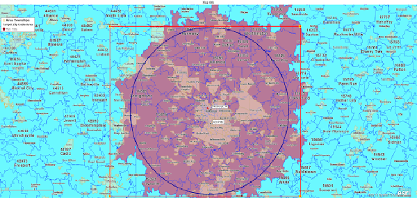
- Avoid national ZIP code views - instead create regional maps of ZIP codes. ZIP codes are very small and nationwide map views tend to lose ZIP code resolution. Focus on key regional areas for your map to get the most out of the ZIP code look and feel.
- Remember ZIP codes come in different types mainly Point and Boundary ZIP codes. Understanding point ZIP codes can help you derive more use from the lowly ZIP code. See this ZIP Point and Boundary video presentation.
- Demographic data segmented by ZIP codes is available with your MBO subscription. Consider adding demographic data to your map as appended label data. See this video on Demographic Labeling.
MBO Across the Internet
Here's a few links to recent MapBusinessOnline articles published outside of the MapBusinessOnline domain:
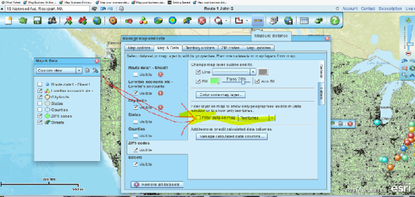
MBO Feature of the Month - Filter Data on the Map
The Data Window displays data sheet views of your map. These may be imported datasheets, territories or areas of interest. The Data Window is useful for filtering data and generating new lists or views of your maps. When viewing a result in the Data Window, a single territory for example, the user has the option of checking the Filter Data on the Map button to view only that result in the map window. To do this check the box in the upper left of the Data Window that is labeled Filter Data on Map. Be sure to uncheck this box when you are done. This is a great way to isolate territories for one-off views.
Remember to uncheck the box when done. Sometimes users forget to uncheck the box. This can cause odd behavior in MBO. For instance, further territory queries will fail. Not a big deal for maps with one or two territory maps, but time consuming for maps with hundreds of territories where you have to find that view that is still filtered. So here's what you can do. If the application is acting strangely and you think it's because you left a Filter Data view checked on, go to Map and Data, hover your mouse over the layer in question, click settings and uncheck the Filter Data on the Map button you see there. You can run this Map and Data review on all layers. Check the territory layer and the ZIP code layer - as an example.