
MapBusinessOnline users invest in our business mapping platform for various reasons and to solve many use cases. However, territory mapping is a common application across almost all MapBusinessOnline clients, regardless of industry.
More advanced territory mapping can be applied to natural science studies or boundary studies using advanced digital mapping solutions. But MapBusinessOnline provides territory solutions for sales and marketing teams, service organizations, and franchising businesses. Our territory mapping software is for everyday business people.
MapBusinessOnline territory management tools assign the geographic extent of each territory to a map alignment layer such as ZIP codes, Counties, States, or City Limits. The significant advantage of tying territory geographies to administrative districts like ZIP codes is that location data associated with the territory areas is easily included as an analysis layer.
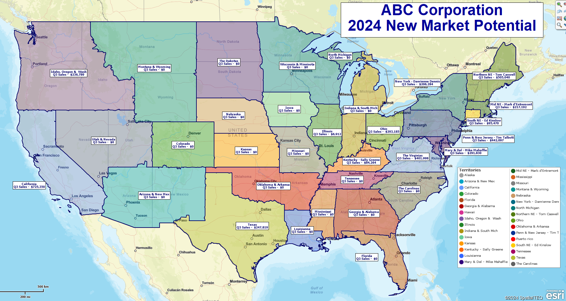
A nationwide territory map based on the ZIP code alignment layer created using MapBusinessOnline.
MapBusinessOnline territory maps are created by lassoing ZIP codes or counties or incrementally selecting the same geographies individually. User can also import territory spreadsheets for quick territory creation.
Combining Digital Maps with Easy-to-use Database Tools
By combining the power of accurate and informative map visualizations with a location database, the map user connects financial, demographic, health-related, and other societal trends with areas of the Earth’s surface. So, instead of creating territories to keep Fred the sales guy out of Frank the sales guy’s hair on the road, businesses can analyze market regions for patterns that point to growth potential, industry opportunities, and future threats to business. These tools can then help Fred and Frank, the sales guys, expand their sales horizons.
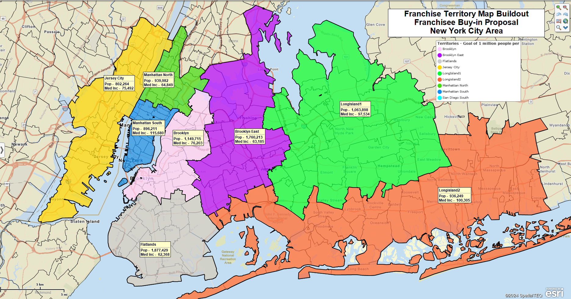
Franchise territory map visualization created using MapBusinessOnline.
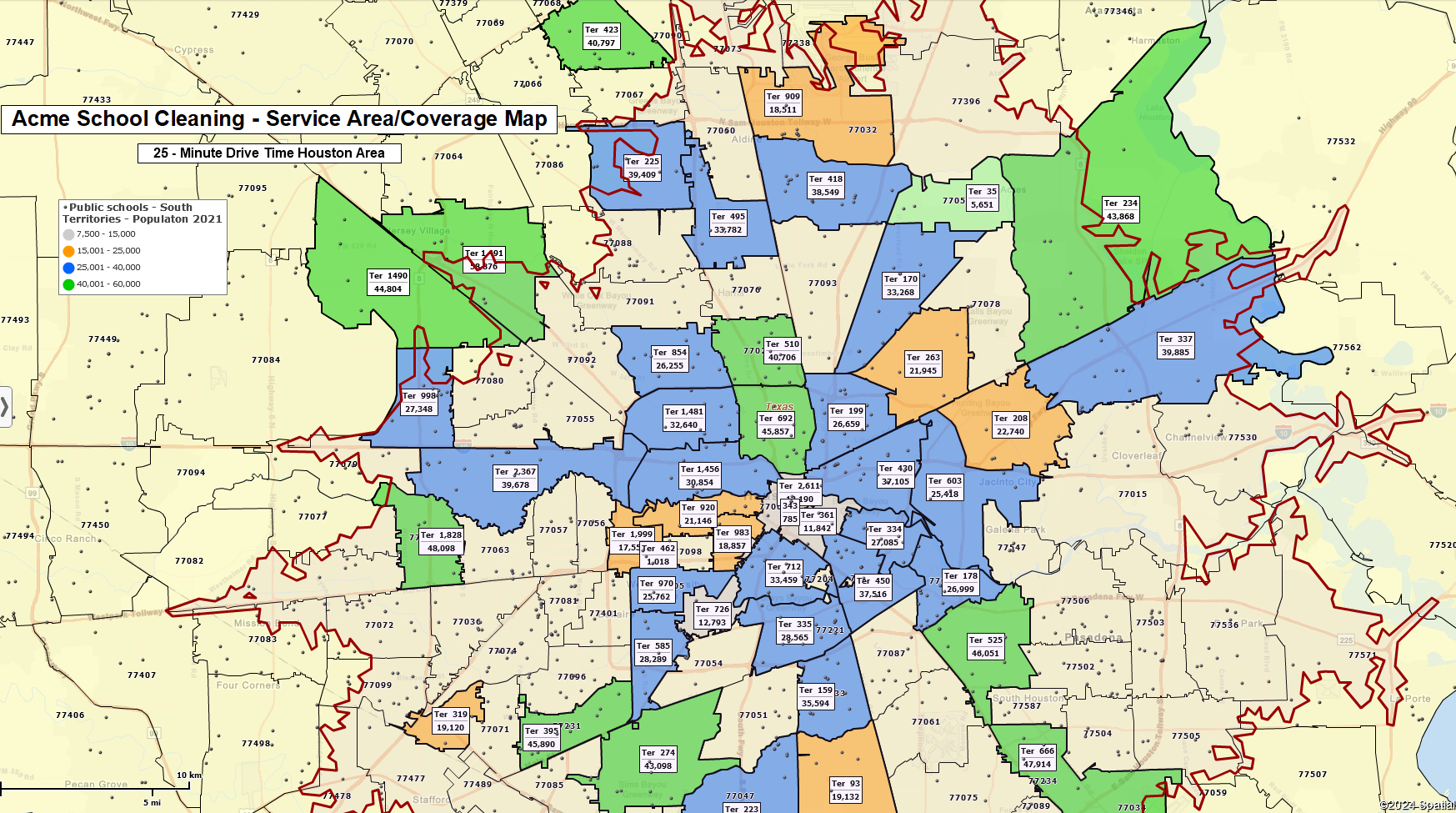
A service territory coverage map created using MapBusinessOnline.
This also suggests that territories created using free-form drawn map features, without location database functionality, are not practical maps for business analysis. The data loses relevance without the structure of ZIP codes, Counties, or City Limits.
I put myself in the position of a business owner. Where would I invest my money if I managed or owned a retail chain, an insurance concern, a bank, or a factory? I would want to invest it in a business I was interested in, where the products or services displayed growth potential. Business mapping software and territory mapping inevitably point to the physical areas with the most growth potential.
Gather Your Relevant Location Data
Territory mapping software provides a digital framework for your business model and a database engine for overlaying location-based data on a business map. Data overlays available to your business maps include:
- Your Business Data – historical sales, prospective customers, industry data.
- US Census Bureau Demographic Data – including – household income, population, ethnicities, and consumer expenditures.
- Business Listings with email addresses and firmographic data.
- Relevant Business Information – Import industry resources, facility locations, and key distribution points.
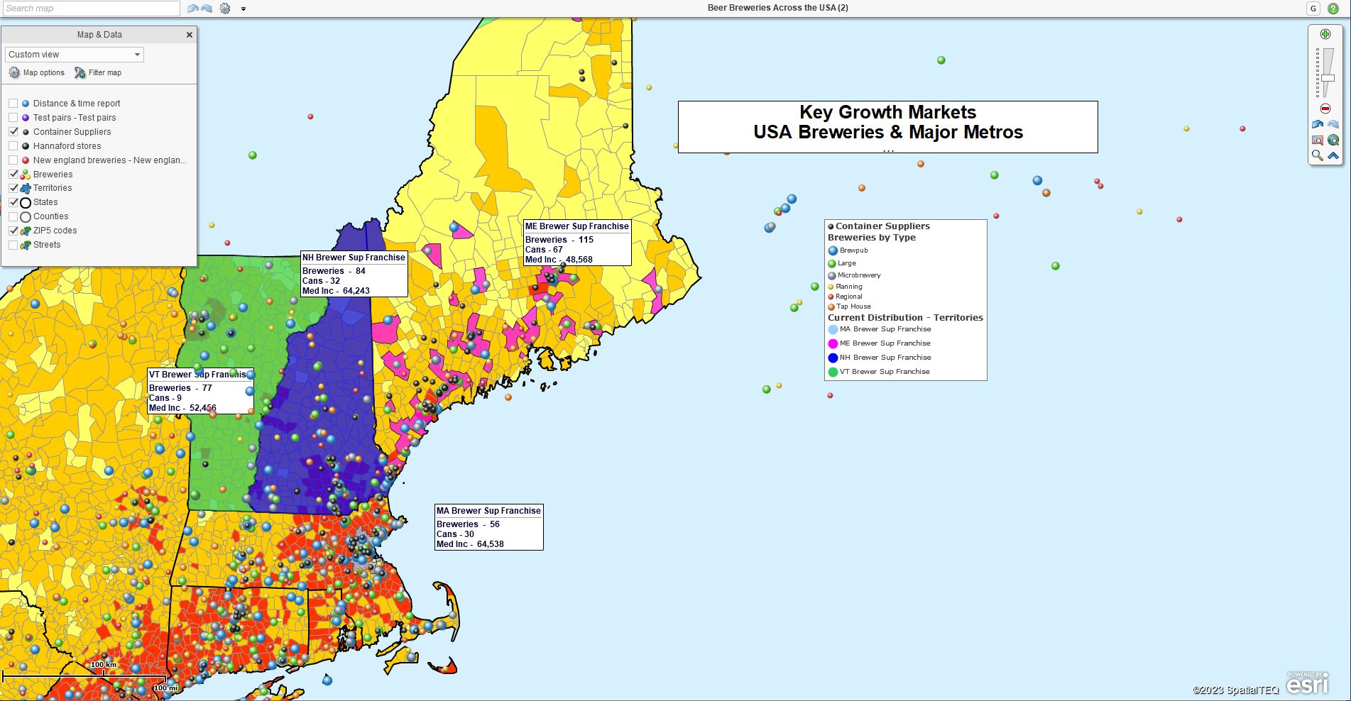
A territory map overlaid with demographic data, business listings, & imported industry data.
Territory and market analysis results offer insights into business channels and frequently suggest a direction for market expansion. Business analysts and management teams apply MapBuisnessOnline driving time and distance queries, demographic analysis, regional map visualizations, and business data representations that enhance problem-solving and strategic planning:
- Banks gain an understanding of the demographic character of areas of investment.
- Manufacturing organizations can view nationwide business activity and make distribution plans and sales representation decisions.
- Large insurance companies expose saturated markets and sales area coverage gaps.
- Construction firms monitor projects and manage contracted labor based on deadlines, inspections, and weather.
- Large and small retailers monitor marketing campaigns and consider optimum driving times for core audiences.
- Medical & dental businesses use driving distance analysis and demography to define their prospective client base and plan for growth.
Territory Management One Pillar of Business Mapping Software
As a business manager for MapBusinessOnline, it is fantastic to recognize business commonalities across our customer base: Automotive part suppliers, billboard marketing firms, beer and soft drink bottlers, car rental agencies, dental practices, financial concerns, floor covering companies, furniture retailers, hospital systems, real estate firms, sales & marketing firms, transportation companies, to name just a few.
Territory management is one pillar of the MapBusinessOnline business mapping service. For many of these large and small businesses, territory management requirements drove them to MapBusinessOnline. Drive time analysis, database management tools, demographic data, business listings, beautiful map visualizations, and more features – why they come with the territory.