
MapBusinessOnline often is purchased as a sales territory mapping tool. There are at least a half dozen ways to create sales territories using MapBusinessOnline. The first five are available in both MapBusinessOnline Standard and Pro. The sixth option, using a multiple driving time search, is available only in MapBusinessOnline Pro.
Learn More About Territory Mapping
The major territory creation options are:
- Lasso the ZIPs – Compile the territories from scratch using a polygon or free form selection tool to select groups of ZIP codes, counties, states, or city limits (Apply only one map layer at a time to a territory scheme)
- Incremental Selection – Select a ZIP code, county, state, or city limit with your mouse cursor and create territories through manual selection
- Import a Territory Spreadsheet – Import a spreadsheet of territory names and either ZIP codes, counties, states, city limits, or Census Tracts (Include a column for State abbreviation for counites and city limits)
- Filtered or Queried Results – Create a territory layer from a map layer query result. Query results display a list of ZIP codes, counties, or city limits that can then be converted into a territory area and assigned a territory name
- Filter a list or range of ZIP codes
- Conduct a spatial query for all cities within a radius
- Create Territories from a Multiple Radius Search – Conduct a multiple radius search and create territories from the radius search results using the Market Analysis tool Search and Segment Data by Radius
- Create Territories from a Multiple Drive Time Search – Conduct a multiple driving time or distance search and create territories at once from the multiple driving time or driving distance search results using the Market Analysis tool Search and Segment Data by driving time or distance in MapBusinessOnline Pro
Lasso the Map Layer
Most business mapping software programs enable territory creation by applying a draw tool lasso. In MapBusinessOnline, select a polygon search tool and create a shape on the web map that encompasses the area of you have interest in. Complete the drawn polygon by returning the line to the start point. Select the map layer you would like to base your territory on – ZIP codes, counties, states, city limits. Now name the territory.
In the Data Window view, which pops up automatically, add or remove geographic data as required using the Choose Columns button in the lower right. You can also add demographic data or imported sales data to the analysis. Once you’ve completed the first territory, all additional territories will include the same analysis data. Read more about Territory Data management using the Choose Columns button.
The undo button for creating territories is the Blue Arrow at the top left side of MapBusinessOnline. To the right of the Address Bar.
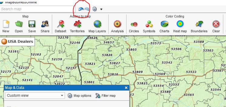
Undo Territory Arrow
Here’s a video describing the process of creating a territory from scratch.
Incremental Selection
Using your mouse cursor, select one ZIP code (county, city limit, state, etc.), hold the shift key down to select more. When finished selecting map layer objects, click Add to Territory. Select the map layer of choice, in this case, ZIP codes, and name that territory.
Please note the options listed on the left side under Create New. Use Create New to name a new territory. Click other options to Edit a territory. See how easy it is to Add to or Update or Remove from a territory? That’s what we call, “Wicked Easy” in Rockport, MA.
The above two methods for sales territory creation are the methods of choice for sales organizations. Both processes lead to the same result – a sales territory scheme that reflects the organization’s sales goals and the sales team’s progress toward those goals. The sales territory tools are used by:
- Manufacturing sales organizations
- Traveling sales professionals
- Manufacturer’s representative companies
- Distribution and wholesale sales teams
Territories from an Imported Spreadsheet
A popular method of territory creation is by importing a ZIP code spreadsheet. The same method works for counties, but you must include a State abbreviation column. That’s because ZIP codes are numerically unique, so no state is required. County names are not unique. Think Montgomery County. It’s in three states.
Include a column for ZIP code and a column for Territory Name.
| ZIP Code | Territory Name |
| 01966 | Alfalfa |
| 01967 | Alfalfa |
| 01834 | Buckwheat |
| 01865 | Buckwheat |
With your import territories spreadsheet saved to your desktop:
- Choose the Create Territories button from the Adding to Maps section of the Master Toolbar
- Walkthrough the import wizard, reviewing the preselected data buckets as you proceed
- In the third import-wizard page make sure the CheckBox to “Ignore Point-only ZIP codes” is checked on (Read about Point ZIP codes here). Click Next
- Click Next to Creating Territories. Verify that the map layer required and the column used to name your territory is correct. Click Create Territories
Once imported, the Data Window analysis view is presented, adjust as in the above lasso approach to include the appropriate analysis layers.
Here’s a video describing the import territories process.
Convert a Filter or Spatial Query Result into a Territory
For whatever reason, you’ve conducted a spatial query or filtered a ZIP code list. Perhaps you did a drive time query and then filtered the results to include specific ZIP codes with a higher than X Median Income value. Those results, presented in the Data Window, can be turned into a territory.
With the results in the Data Window view, click the Blue Puzzle piece button in the Territory section of the Data Window Toolbar that reads Add to Territory. Name the territory, and there you have it – a fourth way to create territories.
Creating Multiple Territories from a Mass Radius Search
MapBusinessOnline makes it convenient to create multiple territories at one time. MapBusinessOnline Standard will allow the user to do this using the Search & Segment Data from Multiple Centers option under the Analysis button on the master toolbar.
Using the Search & Segment Analysis option:
- Select or import a dataset of points
- Choose the radius distance
- You can decide to place a circle on the map around up to 200 points
- Run the query by clicking Next.
- Choose a Map Layer upon which to base your territory scheme
- Make sure to select the Create Multiple Territories option
- Insert a Text Prefix that makes sense for naming. Click Create
Remember it is always easy to undo a Territory Creation option. Just click the Undo arrow at the top left of the MapBusinessOnline application – to the right of the address bar.
Creating Multiple Territories from a Mass Driving Time or Distance Search (Pro Users Only)
The last method for creating territories using MapBusinessOnline is implemented through the same button as number 5, above. The only difference is it requires a subscription to MapBusinessOnline Pro.
That’s because Pro provides the robust database and analysis tools required to crank out multiple center queries using driving time and distance calculations along the North American road network. That, my friend, is a lot of geodata. So it takes a little longer to process the query.
Initiate this spatial search by choosing the first option in Market Analysis.
- Select or import a dataset of points
- Choose the driving time or driving distance option distance
- You can decide to place a driving time or distance polygon on the map around up to 200 points
- Run the query by clicking Next.
- Choose a Map Layer upon which to base your territory scheme
- Make sure to select the Create Multiple Territories option
- Insert a Text Prefix that makes sense for naming. Click Create
Multiple driving time or driving distance territories are terrific ways to generate territories for these business applications:
- Market Analysis in support of business expansion. Because driving times to a store or service center can directly impact the customer experience, this quick assessment of areas of interest and specified driving times can be critical to accurate market assessments. Think restaurant take out or delivery businesses
- Retail Chain Store Expansion – The Search and Segment option of MapBusinessOnline Pro market analysis is perfect for retail store chain expansion and trade area analysis considerations. Multiple address driving time and distance queries make it easy to define the primary customer zones surrounding potential store placements. Add demographic analysis and competing business listings, and you’ve got yourself a thorough analysis
- Service Area Analysis – The service industry is virtually limitless in scope. Regardless of the service your business offers, driving time and distance analysis lets the user define the customer service area scope, determine staffing requirements, or new service center locations.
MapBusinessOnline Standard and Pro software options both provide tools to define areas of sales or service accountability and can add demographic data and business listings to the analysis.
- If your business has never implemented sales territory management, prepare to be wowed
- If your business had territory management through MapPoint, you’ve found your replacement
- And if your business has been paying through the nose for a fancy sales territory manage service, you just found significant savings
Sales territory management in MapBusinessOnline provides tools that manage additional territory mapping requirements including:
- Overlap – See the Map and Data Tab to set up territory intersection options that enable overlap. Overlap in MapBusinessOnlne is defined by a bright or obvious color-shade
- Territory Editing – The same tools that enable territory creation, control territory editing. Add or subtract areas and map object to or from your territories with a few clicks of a mouse
- Territory Analysis – The Data Window offers powerful analysis view of your sales territory. Access demographic data, imported data, and calculated data columns to define and balance territories by data composition using the powerful Choose Columns button in the lower right. Read more about Choosing Columns.
Through creative use of the MapBusinessOnline sales territory mapping tools a business map user can develop additional ways to create territories. Let us know if you find a new and valuable way to create a territory that supports your unique work process.
_______________________________________________
MapBusinessOnline access has officially transitioned from Web Browser (Adobe Flash Player) access to the Map App download access.
- Please download the Map App from the website – https://www.mapbusinessonline.com/App-Download.aspx.
- After installing the Map App, the MapBusinessOnline launch button will be in the Windows’ Start Menu or Mac Application folder. Find the MapBusinessOnline folder in the Start Menu scrollbar. Click the folder’s dropdown arrow and choose the MapBusinessOnline option. You can drag the Icon to the task bar for a quick launch button.
- All saved maps will be available through your Map Library Folder, the second button in from the left on the Master Toolbar. (Green File Folder icon.)
Map App access to MapBusinessOnline.com provides enhanced features and a better user experience.
The Map App includes the new Map Viewer app for free non-subscriber map sharing.
Value-Added Resellers – Offer the tool to your customers as a reseller. Make money on training and consulting. Contact us with further interest in reselling MapBusinessOnline.
Find out why over 25,000 business users log into www.MapBusinessOnline.com for their business mapping software and advanced sales territory mapping solution. The best replacement for Microsoft MapPoint happens to be the most affordable.
Contact: Geoffrey Ives geoffives@spatialteq.com or Jason Henderson jhenderson@spatialteq.com