
Driving time and driving distance calculations enable in-depth analysis for businesses that want to conflate their critical locations with US Census demographics, commuting data, and other essential business elements.
These drive time calculations are large, complex operations. They can analyze the entire USA road network across multiple center points and large distances. That’s a lot of data to process. Be aware that these calculations can take hours to complete.
Results of extensive MapBusinessOnline drive time calculations display in tabular format, usually adding columns to imported datasets. All results are easily exportable as CSV files.
Easier than You Think
Driving time and distance queries can undoubtedly be intimidating to new users – especially for business mapping users who are not used to geographic information systems (GIS) analysis. Terms such as ‘spatial queries.’ ‘shapefiles’ and ‘buffer zone’ can perplex the mapping novice. But that’s why you came to MapBusinessOnline.
In MapBusinessOnline Standard, business mapping analysis involves importing basic address spreadsheets and viewing these location points against a map. MapBusinessOnline enables the summing of demographic and business data by the map layer objects (like ZIP codes) around these points. Most new business mapping users quickly pick up on these features and calculations. Think of business mapping as the next step up from Excel spreadsheets.
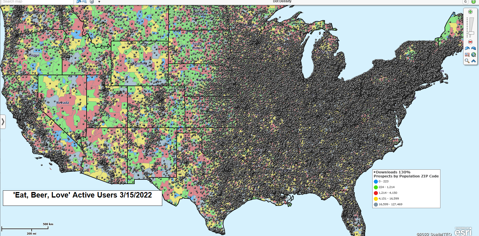
A Giant Swarm of Bees of Just Location Data?
MapBusinessOnline Standard Driving Time & Distance Features
MapBusinessOnline Standard allows a drive time or driving distance calculation around a single point at a time. Each Standard drive time calculation begins by placing a point (address or Lat/Lon) on the map. Point placement is done through the address bar or by dropping a point with a draw tool. Either way, once selected, the user gets the drive time creation option from a menu of services.
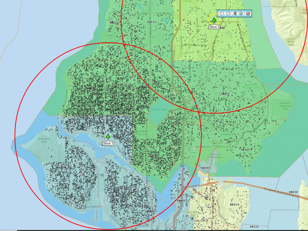
When the drive time or distance option is selected, a user must choose between a stated time or distance, which the application will then use to calculate the results. For instance, a point placed at 100 Main St., St. Louis, MO, might be associated with a 180-minute drive time calculation. The map would then display a jagged polygon around St. Louis with the driving area surrounding the selected point in all directions. Likewise, a user could choose a distance instead of a time, and a similar calculation is initiated based on driving 180 miles in all directions around St. Louis.
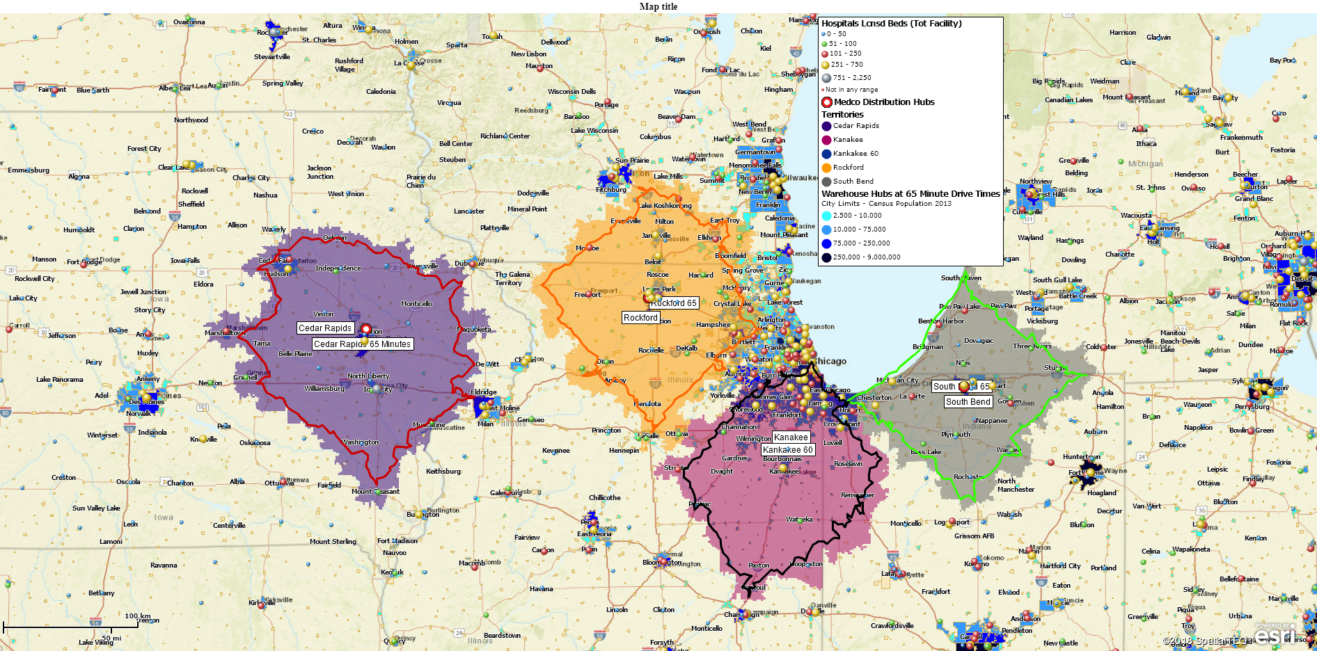
Drive Time Polygons
All shaded areas can be adjusted for color, transparency, and boundary visualization. In MapBusinessOnline Standard, those results appear visually on the map as a Drive Time polygon. In MapBusinessOnline Standard, a drive time polygon can be the basis area for a territory. Sales territory creation would use the drive time polygon as the ZIP code, City limit, or County selection figure – creating one territory at a time.
Drive time polygons are used to sum demographic data categories for the bounded ZIP codes or City limits.
One could also select a DriveTime polygon tool from the set of Search Tools available from the master Toolbar. Click the Drive Time polygon tool and place your point manually on the map. A dialogue appears presenting the option for Time or Distance calculations and the time of day/day of week options. Time of day options makes the calculation inclusive of average vehicle traffic impacts on drive time calculations.
MapBusinessOnline Pro Driving Time & Distance Analysis
MapBusinessOnline Pro extends the Standard driving time and distance calculations, so they apply across multiple center point locations simultaneously. This multi-center point capability enables calculation results to feed into columns of spreadsheet data.
The MapBusinessOnline Pro Analysis button lists the multiple functions of the tool. In a way, the list simply applies our set of driving time and distances calculations to each operation in slightly different ways, which completely change the nature of the results:
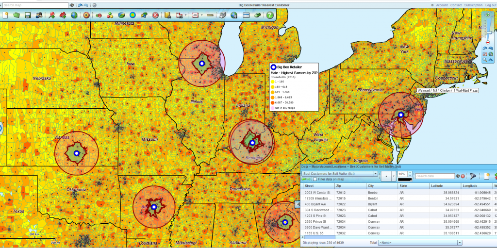
- Search & Segment Data from Multiple Centers – Simultaneously find data within multiple drive time polygons. Supports multiple territory creation.
- Batch Calculate Distances & Times Across One or Between Two Point Datasets – Transportation network analysis adding distances or times between all points. Powerful and sometimes time-consuming queries.
- Find the Nearest – A proximity search. Show me a spreadsheet of the nearest XYZ to all of my locations.
- Aggregate Customer Data and Summarize Demographic Data provide data enhancements based on drive time and distance queries.
Not every customer we talk to requires MapBusinessOnline Pro. But when the customer actually needs driving time calculations, they totally get it. And they like the price too. We challenge you to find Pro functionality for a more affordable price.
Develop Market Profiles
Actual MapBusinessOnline Pro Drive time applications include:
- Real estate assessment and appraisal analysis. Property values and home price levels can be associated with particular areas of interest, providing real estate data queries for buyers and sellers. Drive time analysis allows the map creator to associate demographic and other imported real estate location data with commuting distances, geographies, or property proximities to specific services.
- Retail chain store analysis & expansion planning. With retail chain stores as center-points, drive time analysis provides competitive analysis supporting expansion planning. Retail saturation levels are derived by comparing store densities and demographic realities.
- Retail Product Sales Analysis. Hierarchical sales & marketing tracking by channel, store, and area. Channels can vary – retail chains, manufacturer’s rep outfits, or niche market distribution centers.
- Bank loan analysis and tracking. Loan agencies view city areas and population centers by median income levels and existing loan risks for a given population. Business mapping helps visualize the risk by area while drive time analysis services a realistic area of interest for the study – more than one area of interest.
- Demographic analysis for government planning. Drive time assessments create geographic segments easily paired with demographic data categories, voter registrations, and other business data. City, State, and Federal agencies can easily access geographic analysis tools to build models for planning and assessment.
- Transportation cost analysis. Transportation studies analyzing fuel costs, road degradation, and future needs benefit from drive time and distance queries. Road networks provide the fundamental structure for drive time analysis.
- Sales territory Creation & Analysis. Sales managers are often required to create territory models based on various criteria. Multiple center-point drive time queries present drive time areas that can be quickly and effectively converted into ZIP code territories.
- Market analysis for New Region Exploration. Identify lucrative business regions and find similar areas in undeveloped sections of the nation. Drive time demographic analysis of existing business areas is easily conflated with potential markets.
Baseline Market Analysis Map
Many businesses are turning to MapBusinessOnline Pro because it provides a unique set of features related to driving time and distance calculations that are very expensive to apply using traditional, alternative solutions. Customers who discover these tools and use them stick with us. We’re kind of in a space all by ourselves.
If this blog puts you to sleep, you probably don’t require MapBusinessOnline Pro. But if your palms are sweating and you shut off an Instagram reel to read this, sign up.
_______________________________________________
Find out why over 25,000 business users log into www.MapBusinessOnline.com for their business mapping software and advanced sales territory mapping solution. The best replacement for Microsoft MapPoint happens to be the most affordable.
To access MapBusinessOnline, please register and then download the Map App from the website – https://www.mapbusinessonline.com/App-Download.aspx.
After installing the Map App, the MapBusinessOnline launch button will be in the Windows Start Menu or Mac Application folder. Find the MapBusinessOnline folder in the Start Menu scrollbar. Click the folder’s dropdown arrow and choose the MapBusinessOnline option.
The Map App includes the Map Viewer app for free non-subscriber map sharing.
Please read customer reviews or review us at Capterra, or g2crowd.
Contact: Geoffrey Ives at geoffives@spatialteq.com or Jason Henderson at jhenderson@spatialteq.com