
A few years ago, I wrote a blog about hiking behind my house in an undeveloped York County, Maine, area. Last week a woman from Limerick, Maine, a town next door to Cornish, found my blog and commented on my explorations of Hosac Mountain. A runner, this young mother of six has been running up the 1324-foot mountain for years. (Elevation estimates vary from map to map.)
My blog used a business mapping software map project to track my routes across the area and collect notes on specific locations and places I’d learned about from other hikers.
Since her outreach, we’ve been sharing hiking adventure stories and map files via email. I’ve updated my Hosac mountain area business map for just that purpose – storing Hosac-related ideas and notes. After every hike, I log into my MapBusinessOnline map, and I update the map with additional annotations and route files.
This is a great way to keep track of a specific geography that interests you. Use MapBusinessOnline as a platform for logging geographic information and notes. The map project becomes a scratch pad for data and can later be turned into a full-fledged business or pleasure map.
Tracking My Hikes
I approach Hosac Mountain from the North as opposed to the video, which approaches from the south, up a tarmac road. My trail follows old skidder/logging trails and mowed pathways for RV’s, horses, and snowmobiles. There’s also about a half mile of bushwhacking.
I use All Trails or Gaiagps.com as route-tracking apps on my cell phone. You could also use a Garmin satellite navigation device to collect route files which are especially helpful in areas with no cellular phone coverage. My mountain obsession happens to have a cell tower on top.
My All Trails tracked route was initiated as I left my house with my dog Skye on Sunday afternoon. All Trails routing is a quick setup, and then everything happens in the background. The biggest challenge with tracking your route is remembering to turn the damn thing off at the end of your hike. I can’t tell you how often I get home, forget, hop in the car, and drive downtown to get pizza, ice cream, or hairspray and ruin my route file.
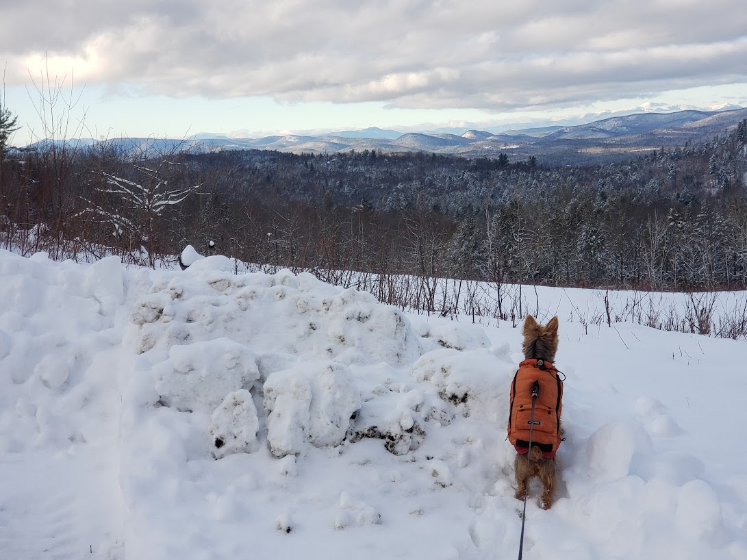
Skye at the great white wall below Hosac.
To easily import a route into MapBusinessOnline, export the file from All Trails as a CSV file. This is done on the web version from your PC or Laptop easier than from your phone. At least, it was for me. I couldn’t get a route exported from my Samsung cracked-screen cellphone.
Once the file is in CSV format, follow the usual import location data import instructions within MapBusinessOnline. The CSV file is made up of a set of latitude-longitude points. Once imported, it displays as a dense line of dots which you can adjust using the editing capabilities in MapBusinessOnline.
I suggest using a colored circle or dot symbol and adjusting the color scheme for the various hiking dates logged on the map. Consider overlying a text label associated with each hike’s layer using the Draw Tool dropdown to access text boxes located on the Master Toolbar.
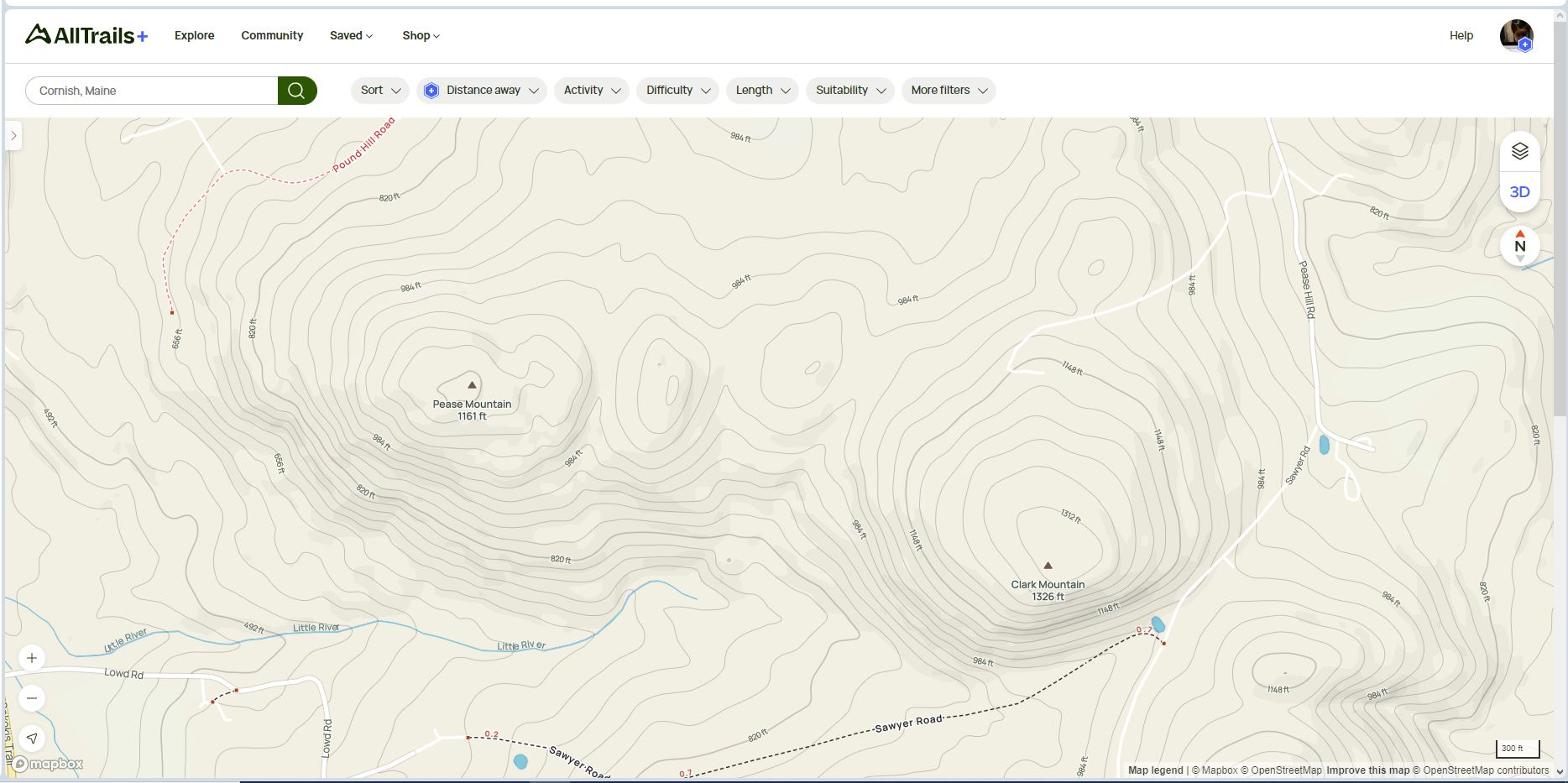
An All Trails view of my hiking area shows no trails.
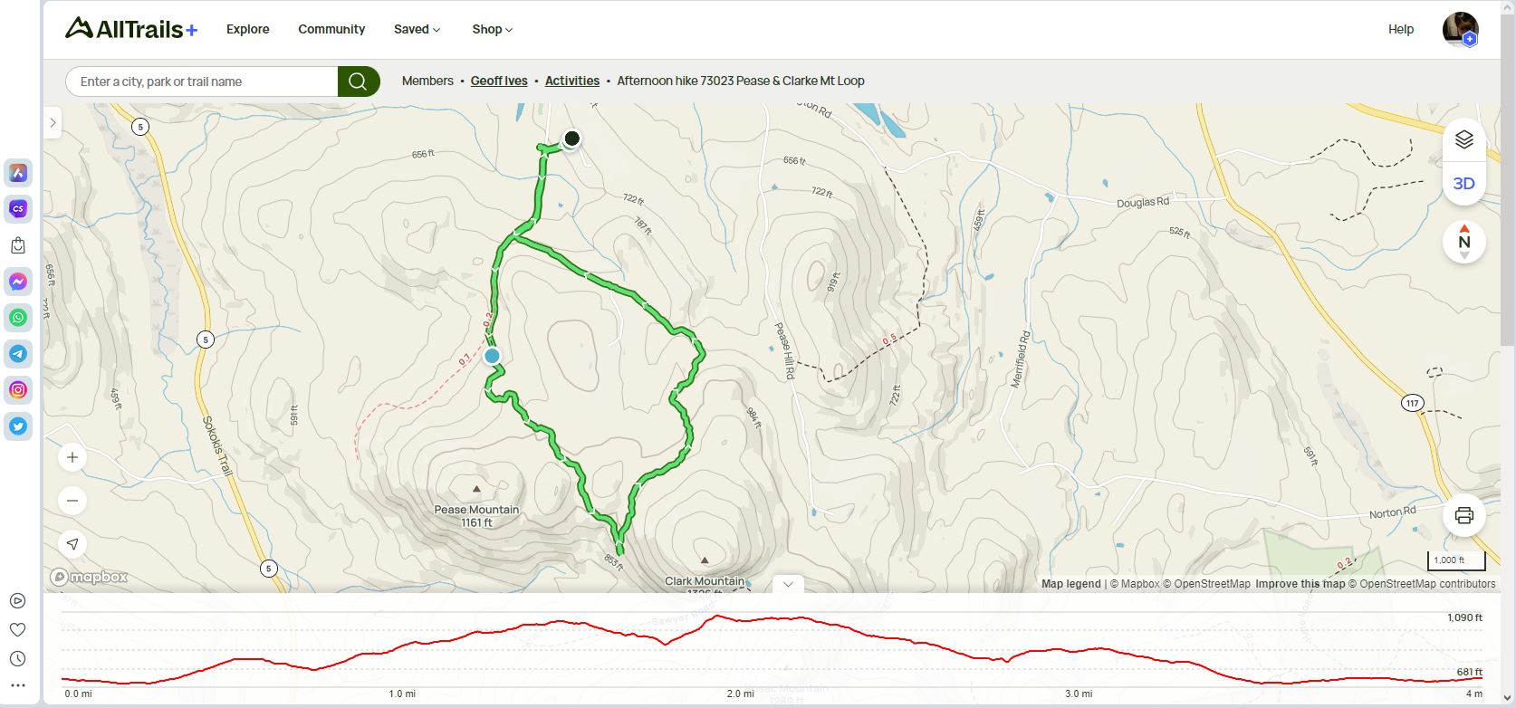
The same All Trails area with my hike on logging, skidder, and mowed trails.
Topographic Awareness
All Trails and other mapping apps offer 3D topographic views. Viewing topography can be very helpful to hikers or people who work in the wild. It is very easy to be misled by a paper or online map that doesn’t clarify elevation through contour lines or faux 3D.
Here I am, an alleged mapping expert who once worked for a company that created one of the world’s first 3D mapping software products – DeLorme. And I ignored topography last April when I decided to go way beyond my usual Hosac area and break new ground. New ground for me anyway.
It was a bad decision. I knew where I was, but Skye and I walked 11.5 miles that day. I had to carry her over a few bushwhacking sections. I hadn’t thought enough about the contours of the land. Things got really steep quickly, and the prospect of returning up those hills was not appealing.
But I sallied forth, got a little lost, and eventually got myself to the neighboring Sawyer Mountain, where I could navigate through thick woods back to my home area. I believe if I had considered topography a bit more, I would have limited my excursions that day and been able to stay awake for an episode of Slow Horses that evening.
I will mention that satellite or aerial can help expose non-official trails. If you stare at a sat map long enough, you’ll see the trails, especially if you are familiar with the area. Satellite map backgrounds with or without streets are available in MapBusinessOnline.
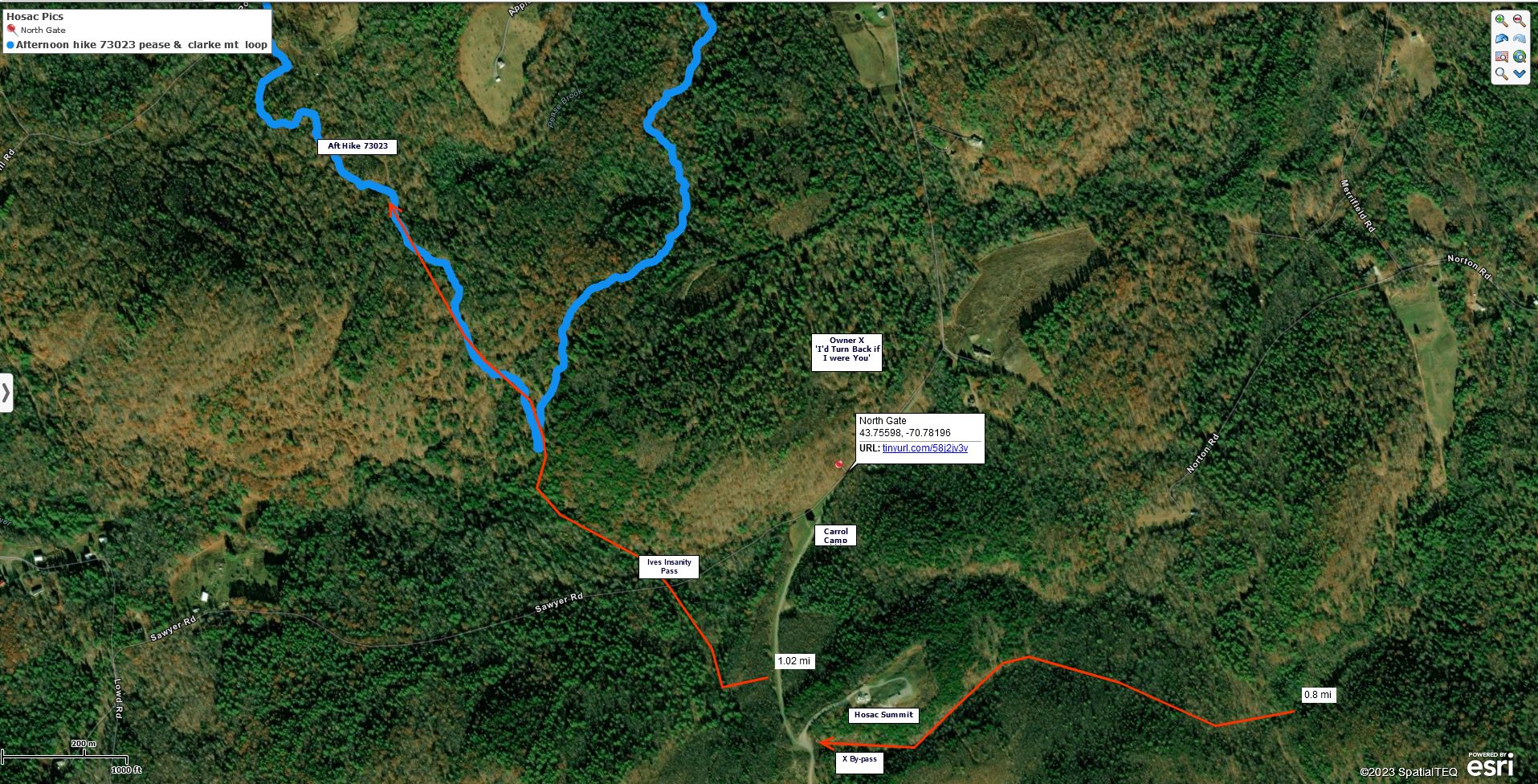
My blue route file over the estimated red distance line layer in MapBusinessOnline. I was pretty close!
Annotating the Map
Adding map annotations adds value to the map for map viewers. Annotations in my personal mapping world would include the following:
- Distance measurement lines – On MapBusinessOnline, under the Drawing Tools section of the Master Toolbar, is the Distance tool. Add lines that represent rough routes and note the mileage presented. Great for ball parking, hiking, and running distances.
- Circles, polygons, and rectangles – Highlight areas of interest for the map viewer to consider. Search for data within map objects.
- Text Boxes – Add notes to the map or name trails, roads, or sections. There’s a Map Title option in Map & Data / Map Options. The Save dialogue lets you adjust your map project name that appears along the top border of the map screen.
- Images & Links – Images can be added to the map via points if they are URL links within a dataset.
- Route files – Import CSV files and GPX route files for map overlays of hiding and driving routes. Imported CSV files are really just an imported point dataset.
As you can see, a map project can be simply a digital place to jot down notes and save route files. This can be applied to business maps and pleasure maps. Use MapBusinessOnline to store geographic ideas, experiences, and references for a future final map presentation.
In MapBusinessOnline, you can always save a map as a My Template map or another My Map. This is a powerful way to approach future map work because it allows you to use past maps as the basis for future projects.