How to Export ZIP Codes by County
Every couple of months we get this inquiry via chat or email, “How do I export all of the ZIP codes bounded by a county or a set of counties?”
This is entirely doable in MapBusinessOnline, but it is more complex than simply exporting ZIP codes segmented by territory – which is pretty straightforward and noted below. To Export ZIP Codes by ZIP Code Territory:
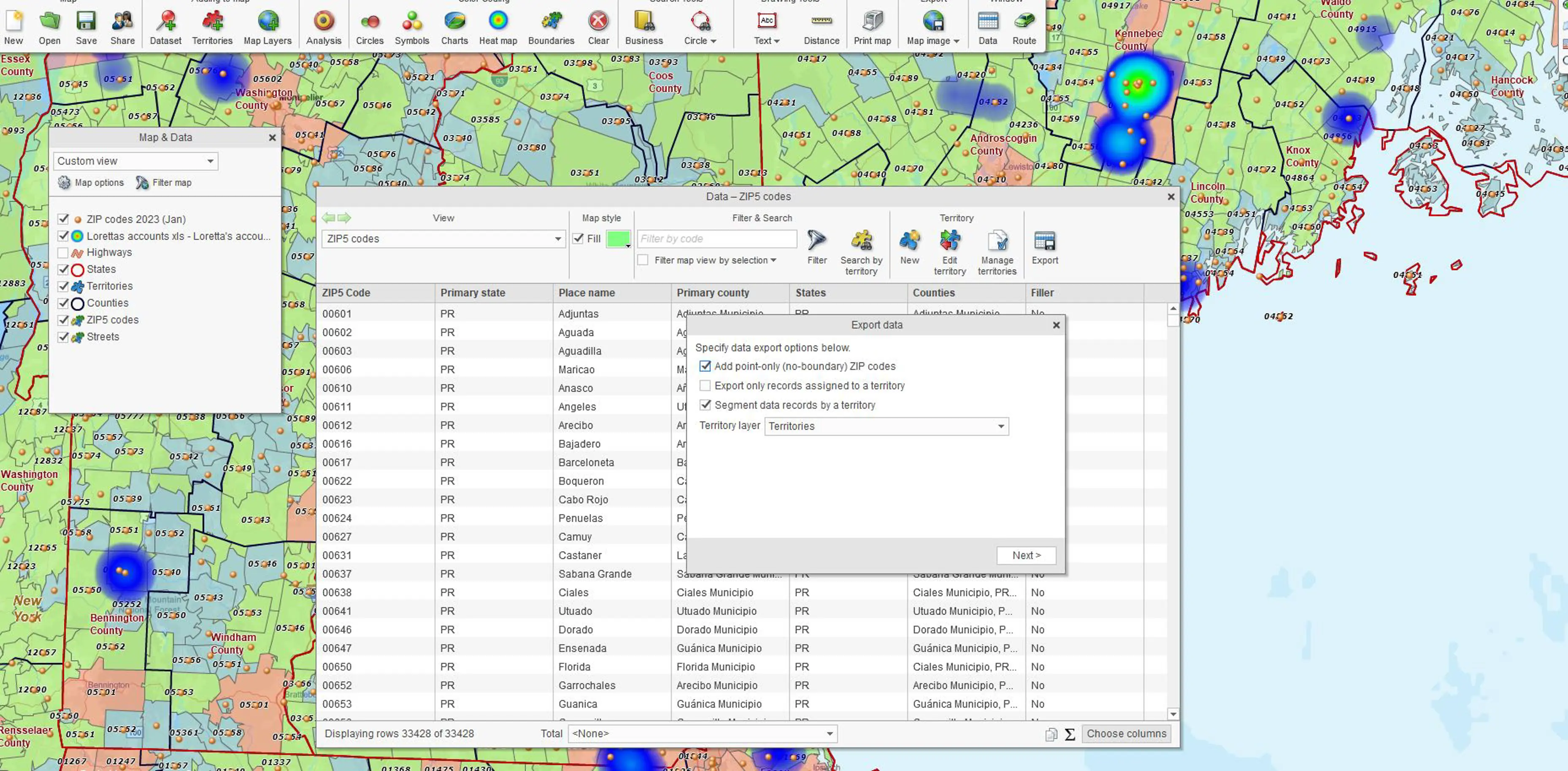
- In the Data Window, select the ZIP code layer
- Click the Export button on the far right of the Data Window Toolbar.
- Select the options you prefer for export and click Next.
- Save the file.
MapBusinessOnline includes multiple map alignment layers for both map visualizations and territory creation. Map alignment layers in MapBusinessOnline include ZIP codes, city limits, counties, states, MSAs, congressional districts, and Census tracts.
Occasionally, users request the process of exporting ZIP codes by County. It seems appropriate to dedicate a blog to the subject.
Exporting all ZIP codes or a subset of ZIP codes by County is an advanced operation in MapBusinessOnline. This ZIP code mapping process requires several extra steps.
The Down and Dirty Option
If it’s just one County, you can always turn on the ZIP code and County layers, adjust for transparency, and then use a polygon Search Tool to lasso all the ZIP codes. Save the file as a CSV; faster than you can say, ‘Bob’s your uncle,’ you get a list of ZIP codes associated with a county or even a group of counties.
For more complex County pulls, we recommend creating territories out of Counties. You can then export the ZIP codes based on the Territory or Territories.
However, because ZIP codes and Counties do not align perfectly and are a many-to-one data relationship, you must upload our complete numeric Boundary and Point ZIP code dataset. Read more about Point ZIP codes here.
Show Me All My ZIPs by County
In MapBusinessOnline, there is a way to query each territory and generate a list of all ZIP codes – boundary or point-based – within that territory. To accommodate this analysis, we’ve included a dataset of all ZIP codes in the MapBusinessOnline Dataset import process.
- First, import that complete ZIP code list. Click the Datasets button – under the Adding to Map section of the Master Toolbar.
- In the Select Data dialogue page, choose the Public Data option.
- Scroll through the data options to the bottom and select ‘Zip Codes 2023 (Jan)‘ or a more recent version, then process by hitting Plot. This puts the entire ZIP code list in your map as a point layer. Every ZIP code in the nation is on the map, point, or boundary, represented by a dot. In Map and Data, you can uncheck the ZIP Codes 2023 layer to get all those ZIP code points off the map. Alternatively, you can make the symbols really tiny.
- With the County Layer turned on in Map and Data, create a territory or series of territories out of the counties you are interested in searching for ZIP codes.
- In the Data Window drop-down, select the imported ZIP code layer – ZIP Codes 2023 map layer. (Do not select the usual ZIP code layer.)
- Click the Export button on the far right of the Data Window Toolbar.
- Choose to Export Records Only Assigned to a Territory
- Click Next to Process the Export and Save your work.
That exported spreadsheet has a list of all the ZIP codes exported and segmented by County Territories.


