Territory mapping is perhaps MapBusinessOnline’s most popular and powerful feature. Thousands of users apply MapBusinessOnline toward territory creation out of ZIP codes, counties, and other map alignment layers. Territories define areas of accountability and create market analysis zones.
MapBusinessOnline supports territory creation for sales organizations, franchise businesses, and service companies. But once a territory is created, what additional map features can be added to a business map to improve a territory map’s usability and functionality? How can we add value to our territory maps without overwhelming the map viewer?
Simply put, we add map features only to complement and support the map’s purpose. Never add data, map layers, or text that distracts the viewer from the task at hand.
Import Location Data
Customer and prospect data are two valuable location datasets any map user can import to enhance their business territory map. Visualizing customer and prospective customer locations overlaid on a territory map is a robust and informative way to define accountability and reveal an area’s business potential.
Whether your territory maps support sales, franchise business, or service accounts, every business needs to organize its business geography into sections to manage all tasks effectively. Territories divvy the work among a team of salespeople, franchisees, or service techs. Adding customer and prospect address data to the territory map is a no-brainer.
Other location datasets can provide value – consider location data of industry resources or store locations. Just keep the data imports relevant. Read on for more addon layers that benefit territory mapping.
Jurisdiction Geographies
Counties, city limits, and ZIP codes are the most popular map layers for creating MapBusinessOnline territories. But these jurisdictions or administrative geographies are also beneficial as demographic presentation units.
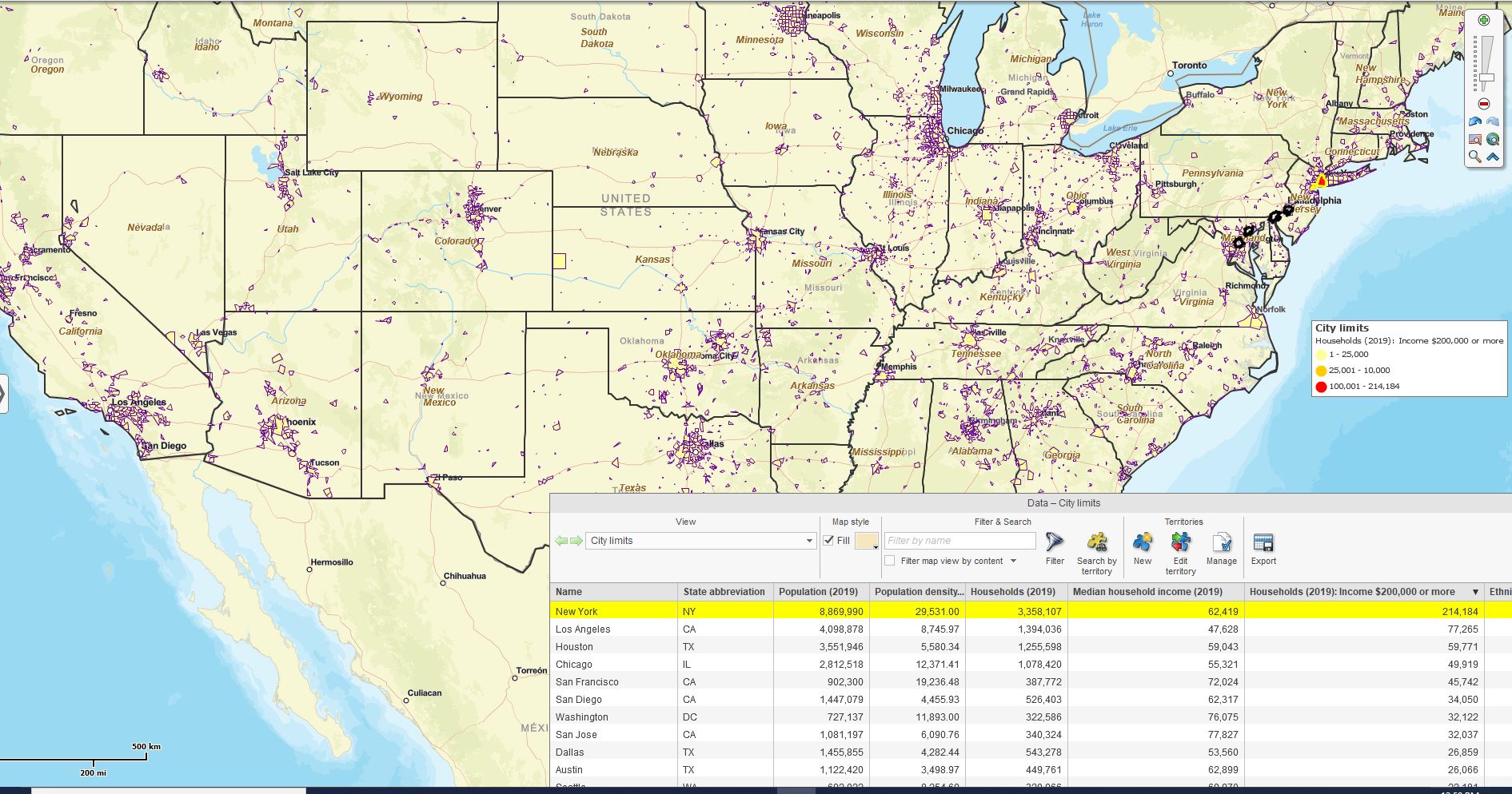
Major urban areas, simply because of their concentration of population, provide territory maps with a way to segment and organize map-based market analysis. MapBusiness Online’s city limits map layer can quickly identify areas of optimum sales potential based on demographic data such as overall population, high-income levels, or population by age group, depending on what categories best fit a product or service’s marketing target.
In this way, city limits are an essential territory map addon for companies selling products nationwide, enabling fast identification of the top ten or twenty urban areas for further study. From that point on, the analysis can get more granular. Further investigation will expose nuances in city limits where New York City boroughs and Los Angeles neighborhoods must be accommodated.
When considering city limits, consider how sprawling the urban area may be. Consider Houston’s sprawl, Dallas and Washington D.C.’s wealthy suburbs, and how San Francisco and San Hose are two distinct and vibrant market areas in many instances. City limits data can be supplemented with ZIP code analysis around extra large urban areas or areas where product interest runs exceptionally high. Don’t be afraid to drill down into smaller geographies for deeper analysis.

Number of Households by City with Income Over $200,000.
Understanding a geography’s key demographic characteristics helps marketing and salespeople plan campaigns. Some territory maps can benefit from a simple thematic map background based on a key demographic. Population is a popular demographic theme, but variations by ethnicity, age, or gender may be more appropriate depending on the product or services involved.
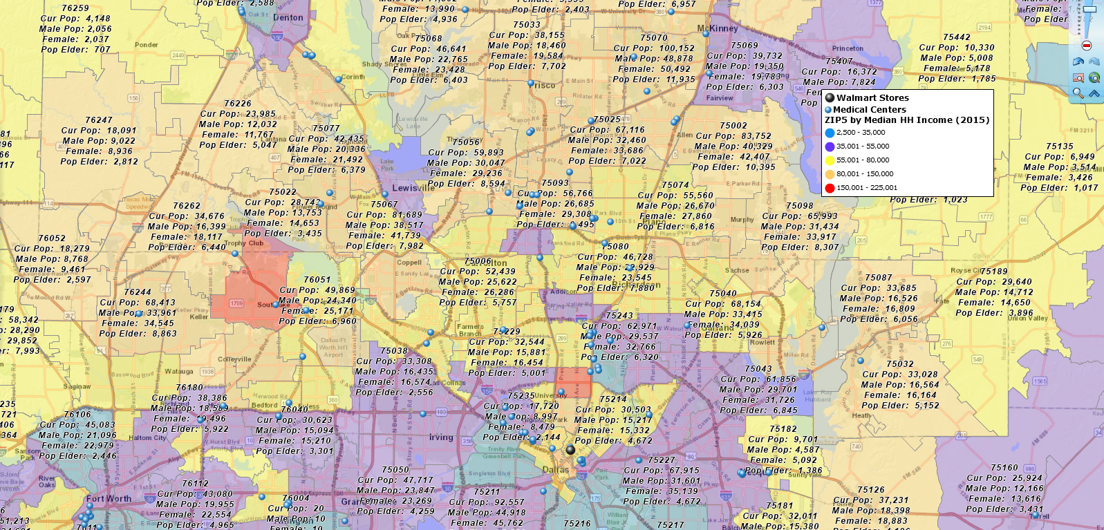
Thematic maps apply color coding by ZIP codes or counties based on demographic data. Keep those color options simple – perhaps only three shades of blue or red – to make that background easy to understand and allow the viewer’s eyes to focus on critical customer data or other map details pertinent to the map’s purpose. An excellent thematic map background informs without distraction.
Demographic data can also be appended to any map layer and territory labels in MapBusinessOnline. These label addons display within map layer text boxes and provide the map viewer with more information about the demographic character of an area of interest. For example, ZIP code map layers can identify the population of any given ZIP code right beneath the ZIP code label.

Let ZIP Codes inform your map audience.
Extra Map Layers
Territory maps can sometimes benefit from other map layers. MapBusinessOnline provides access to additional geographies, including Census tracts, congressional districts, and Metropolitan Statistical Areas (MSAs).
These extra map layers are located under the Adding to Map section of the Master Toolbar. Here, you will also find the Highway Map Layer. Highways are a nice orienting layer for large regions or whole country maps.
A map viewer may find the appearance of Route 95 helpful while taking in a map presentation of the new area of growth projected by the executive team. Always avoid making your map audience feel lost when viewing a map. The last thing you want during a map presentation is to have someone on the executive team wondering where the hell they are.

Bob’s lost again.
GPS Tracks
Sales territories often encompass a traveling employee’s route area. Route efficiencies are subject to stop-off requirements, scheduled appointments, and emergency dispatches. Still, all repeated routes are subject to review for expense reductions where possible. I am always amazed at the business that supports overlapping traveling employees, crisscrossing each other’s tracks as they go through their daily routes.
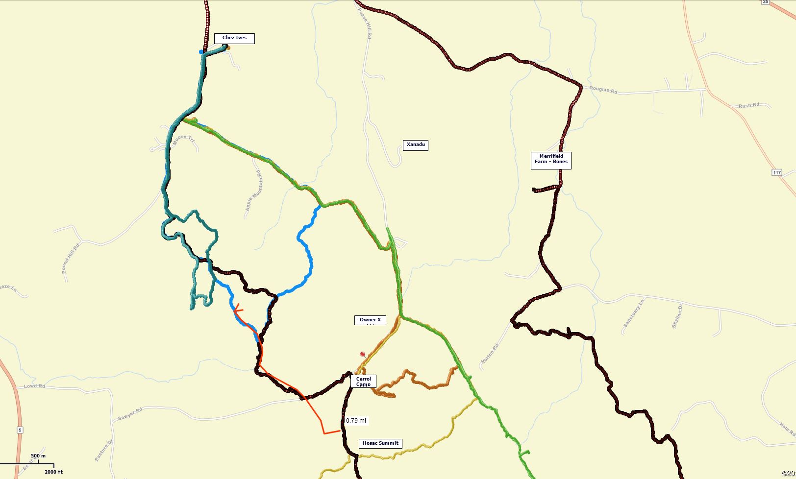
MapBusinessOnline supports the import of GPS route files. Any traveling employee can track their travel by uploading a free route tracking app onto their cell phone. These GPS tracks are exportable in CSV or basic spreadsheet format and are easily imported into MapBusinessOnline.
GPS track files, once imported, can be color-shaded and symbolized for optimum display purposes. Multiple CSV file imports can be overlaid on the territory map to analyze travel patterns and coverage areas.

GPS track files are uploaded to a business map for review.
MapBusinessOnline only allows one user-generated route file at a time in the Route Window. The import of GPS track files allows business map users to view multiple tracks and a MapBusinessOnline route all on the same map project. This works well for travel efficiency studies, expense analysis, and territory balancing.
Further map combinations can be achieved using the Microsoft Snippet tool or other screen capture applications. This would be the approach I would take for generating PowerPoint Presentations. For instance, I would use the Snippet tool to:
- Capture Data Window data views and Map Visualizations at the same time.
- Overlay additional, non-cartographic imagery on top of a map view.
- Generate focused zoomed-in area of interest images with no other distractions.
Get creative with your territory map addons to enhance the overall value of your map for your map-viewing audience. Keep your map uncluttered, and your additions focus on the map project’s purpose; your viewers will love you for it, and so will Bob.
Go to Www.MapBusinessOnline.com to learn more.
