
So you need to create a business map for a project at work. Maybe you are a business owner and know you need to view your business data geographically to make some critical decisions. Or perhaps your boss picked you from a list of people options and asked you to build a business map for the company. In which case, congratulations! It means she trusts you.
You spent some time online searching for the right business mapping software solution, and now it’s time to get down to brass tacks and generate a business map for your planning meeting next week.
The Prep Work
You must import a spreadsheet of locations to describe critical business issues with map views, especially if you support sales and marketing folks with business mapping. And if you’re working for a typical business, that location spreadsheet will have hundreds to thousands of location points. I have good news and bad news for you.
Here’s the good news: The data preparation component of your mapping project is the hardest part. Once you get past your first location-based spreadsheet and start working with the data on the map, you will love business mapping.
Ok, now the bad news: You should not shortcut the location spreadsheet.
What do I mean by a shortcut? Sometimes the prospect of developing a list of all customers, resources, patients, prospects, vendors, or other business locations, can be overwhelming for the new business mapper. So instead of plotting full address data, they plot using just State or just ZIP code locations.
Find the Best Data Available
We’re all so used to having downloadable, instantly available data. You should conduct some due diligence and see if you can find a spreadsheet with addresses or latitude and longitude coordinates that already exists in your business. Your business address data should be available from the accounting, marketing, and sales departments. They need addresses to send out invoices, marketing pieces, or sales offers. You may find administrative assistants around the office have client addresses neatly stashed in spreadsheets. Ask around. Beat the bushes. Have somebody compile address lists using the Internet. It may feel like a project, and it is, but the results will be worth the trouble.
The first place I would look is in your company’s CRM. Your CRM could be Salesforce, SAP, Oracle, ACT!, HubSpot, ZoHo, or another CRM software player. Customer Relationship Management software usually allows the export of customer lists to CSV or Excel files. Go there first.
For MapBusinessOnline, you’ll need a spreadsheet that includes the Name of the location plus separate columns for Address | City | State | ZIP code. Or a column for latitude and a column for longitude coordinates.
Many people come to us with spreadsheets with just Name and ZIP Code columns or Name and State. Unfortunately, these addressing options will not lead to a memorable business map, at least not memorable in a good way.
Compare the two maps below. The first shows congregate homes for the elderly imported by address and color-coded by type. The second uses the same data imported by the State only.
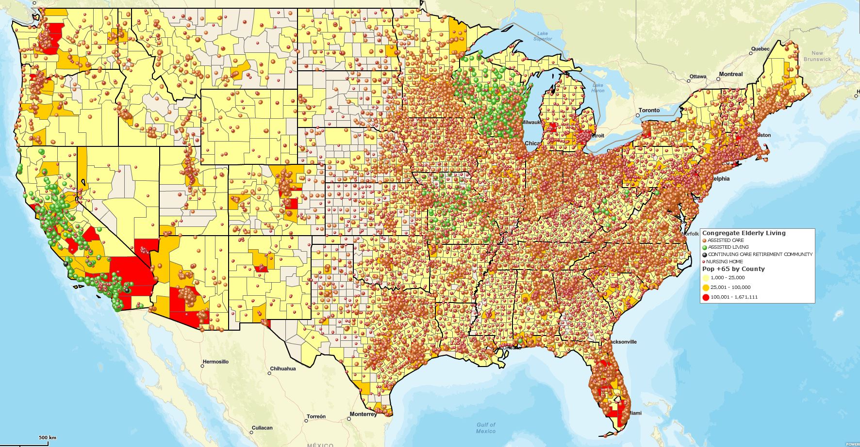
Elderly Congregate Homes by Address.
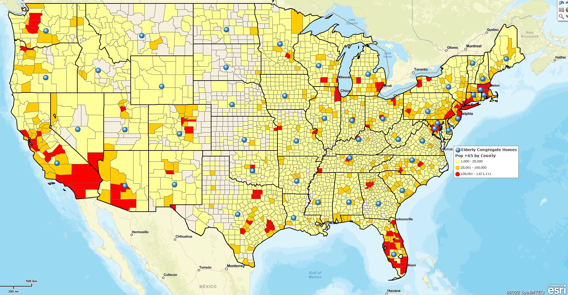
Elderly Congregate Homes by State.
See the difference? Note the big blue dots on the second map. They represent all those congregate homes from the first map geolocated by State only, not by address. When you import a spreadsheet by address or latitude and longitude coordinates, you derive the maximum benefit from your location data and mapping application. Additionally, importing by State, County, or ZIP code only leaves value out of your business map:
- Map visualizations become meaningless.
- Color-code options by classification or numeric value are lost.
- Density views or heat-mapped activity no longer have an impact.
If you want to be a mapping hero, find your critical location data addresses. Otherwise, you better cancel that ticker-tape parade.
Dot Density Map
Here’s another example of the power of address-based location data. Using the same map and data above, I have shifted my symbolization of the address-based congregate home data. I am now using a relatively small, black location point. The data clearly shows groupings or clusters where many locations exist in a limited area.
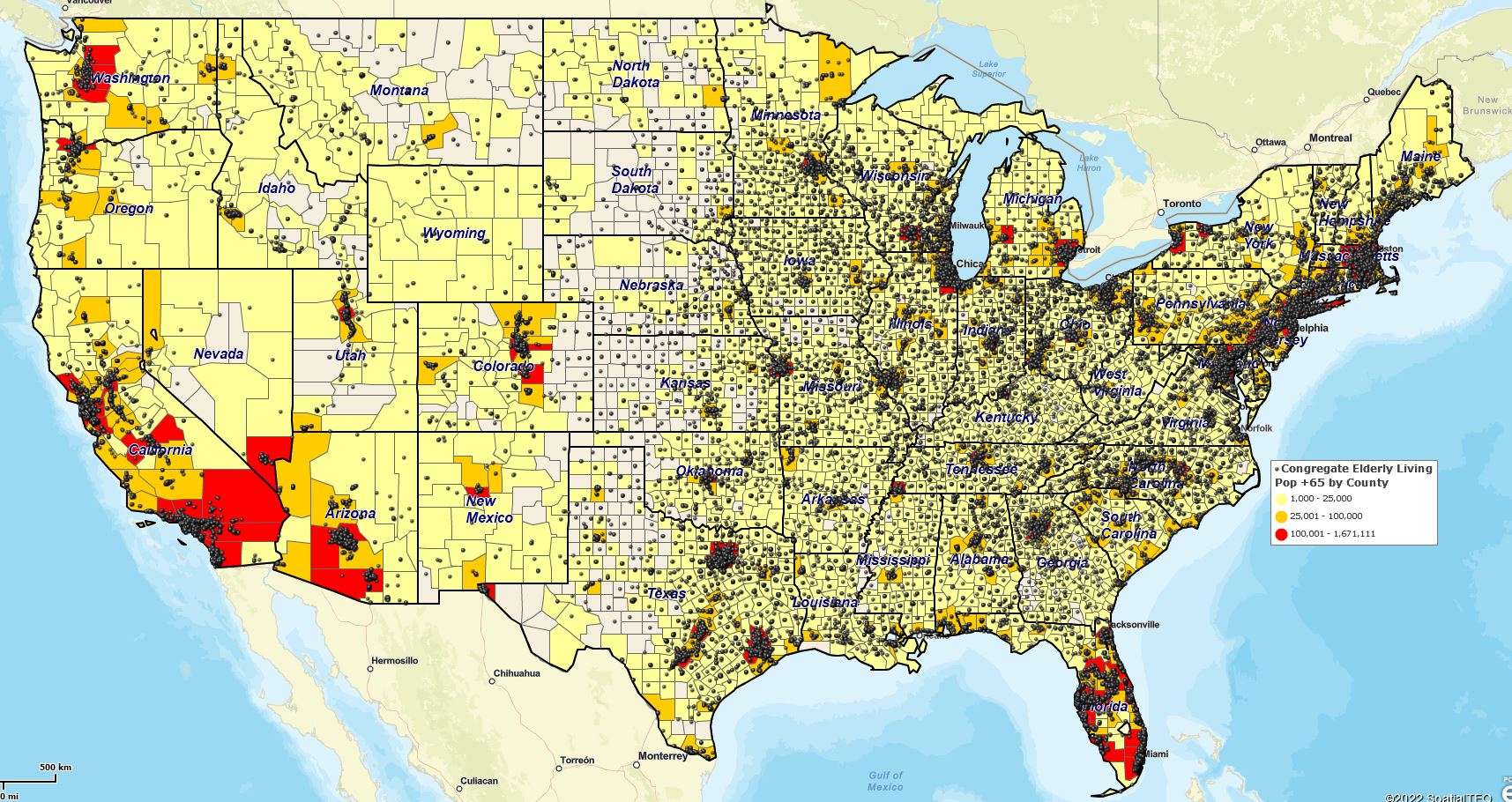
Elderly Congregate Home Dot Density Map.
Dot Density Map quickly tells the map viewer where the action is. All those clustered areas indicate locations with plenty of older Americans. So if you don’t like Shuffle Board and rediscovering the hits from the 1950s, avoid those clustered dark areas.
So I think I’ve made my point—import location data with full addressing.
Once you’ve imported your data, use these articles to help yourself create a compelling and informative business map for your map viewer to view. Your boss will remember you for it. And maybe he’ll sponsor a ticker-tape parade. But don’t hold your breath.
- Boldly Create Your Business Map.
- Create a Business Map from Scratch.
- 6 Wicked Easy Ways to Create a Territory Map.
- Creating and Optimizing a Business Map Visualization.
- Import Address Spreadsheets into MapBusinessOnline.
_______________________________________________
Discover why over 25,000 business users log into www.MapBusinessOnline.com for their business mapping software and advanced sales territory mapping solution. The best replacement for Microsoft MapPoint happens to be the most affordable.
To access MapBusinessOnline, please register and download the Map App from the website – https://www.mapbusinessonline.com/App-Download.aspx.
After installing the Map App, the MapBusinessOnline launch button will be in the Windows Start Menu or Mac Application folder. Find the MapBusinessOnline folder in the Start Menu scrollbar. Click the folder’s dropdown arrow and choose the MapBusinessOnline option.
The Map App includes the Map Viewer app for free non-subscriber map sharing.
Please read customer reviews or review us at Capterra or g2crowd.
Contact: Geoffrey Ives at geoffives@spatialteq.com or Jason Henderson at jhenderson@spatialteq.com