Business mapping doesn’t solve all problems, but it can sometimes lend a new perspective on that nasty problem your business has been trying to solve for a while, with no luck.
Problems come in all shapes and sizes. Business mapping software can’t claim to fix a leaky faucet in the upstairs bathroom, but business mapping could expose relationships surrounding an epidemic of leaky faucets across an entire city.
The applications for business mapping and GIS are very horizontal. That means almost all industries can apply online business mapping to their business challenges.
Law Enforcement Agency
A police department might use business mapping to plan the entire years’ list of driving-while-intoxicated check points. These DUI Checkpoints might be determined based on traffic patterns, a history of violations, and perhaps by choosing a new spot for a check-point to add the element of surprise. I have no idea. But, those are all location data related factors that would help the authorities say it with a business map.
The process would include uploading a list of location addresses or coordinates to an accurate business map. With all those locations represented as points on the map, officers can view possible stop locations that make the most sense strategically. They might view the street data and select traffic stop-points that avoid a major traffic jam, allow room for processing questionable drivers, and provide minimal escape routes.
The DUI map can be saved as a tracking document for past and future DUI check points. Business maps are fantastic record keeping devices. Imagine the feeling of contentment officers will feel viewing the past five years of drunk driving checkpoints map.
Insurance Company
Large and small insurance firms record their claims data around location-based events (hurricanes, fires) and the locations of insured assets using business maps. Problems described by a business map might include risk assessments by zone or tracking mitigation and remediation by disaster area.
We all know the USA Gulf Coast residential housing stock has had some serious risk assessment insurance analysis applied over the last decade. Insurance companies are way ahead of the current Federal government when it comes to climate change assessment because rising sea levels are a major factor in their business future. Forget the current Environmental Protection Agency, real science is being conducted and appreciated in the insurance business. They are saying it with insurance business maps.
Insurance assessments include reviews of risks based on weather, crime and other hazards to home values. Business maps are an excellent way to visualize actual property values and risks by claim or asset, and then roll those risks up into area-based risk portfolios. Use business maps to explore insurance risks by area, demographic category, and human activity.
In addition to risk analysis, insurance business apply Map Business Online territory alignment tools towards field claims management. Claims territory mapping helps balance adjuster workloads and track progress overall.
Further, insurance companies use aerial imagery, including drone collected imagery, to monitor site work and remediation contractor activity. Drones can come pretty close to providing real-time awareness to busy claims adjusting organizations. Map Business Online can be used to track those drone collected portfolios. Contact us to explore how your insurance company can say it with a business map.
Chemical Company
Speaking of risk, if you run a chemical company it will help you sleep at night if your company has a pretty good idea of where all their chemicals are stored and an accurate awareness of what dangerous chemicals are on the road at any point in time.
Business mapping is used to create facility maps that track product by warehouse. Regularly updated inventory levels can display allowable levels of chem-storage supporting seasonal or market-driven chemical requirements by region. Color-coded symbolizations on a business map depict where dangerously high levels of chemical storage may be occurring.
Being aware that an overabundance of any dangerous chemical by area will help mitigate risks across a storage network. Awareness is half the battle, enabling supplies to be regulated and sales efforts to be ramped up, as storage levels are equalized. Chemical managers say it with business mapping.
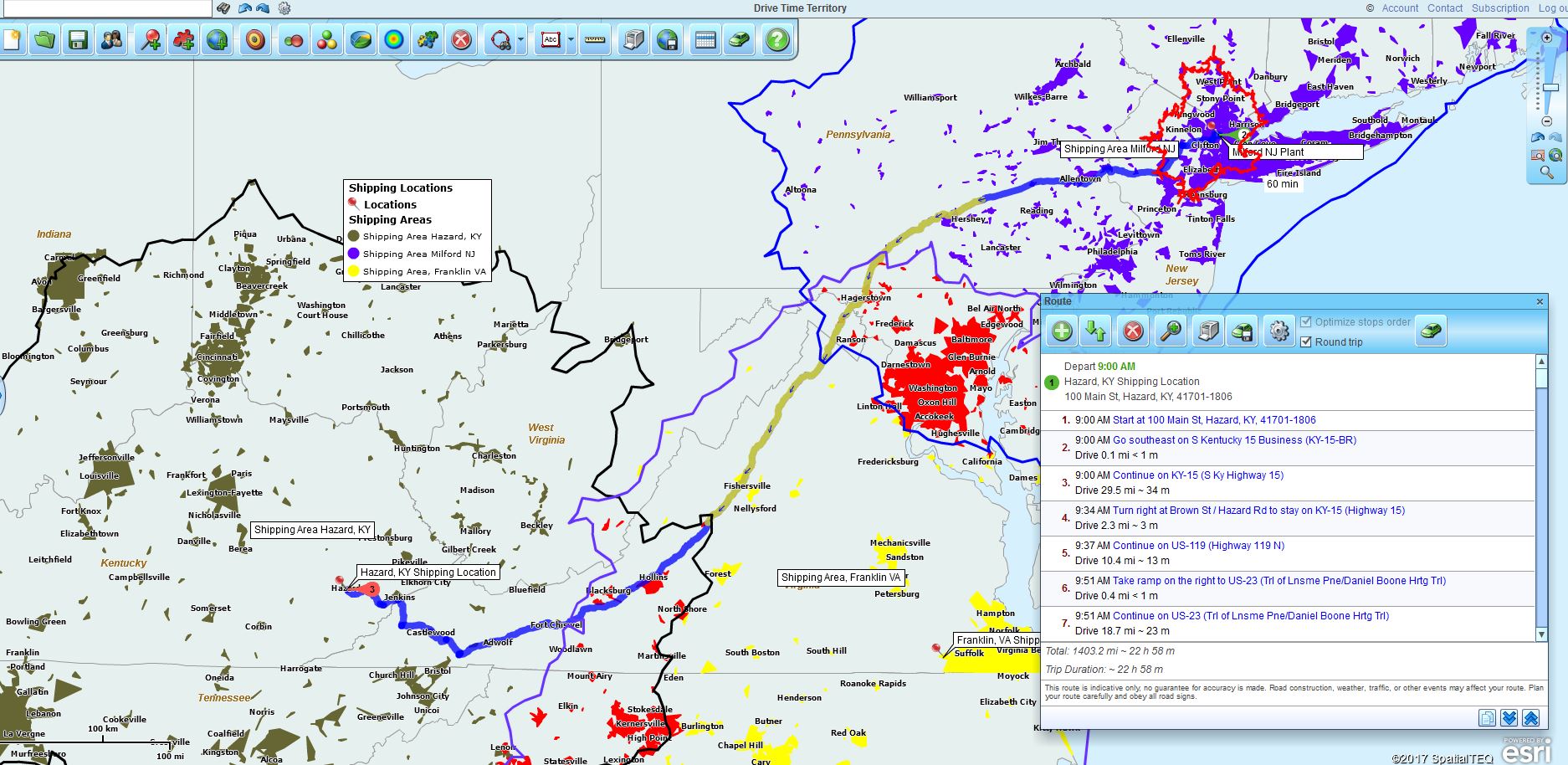
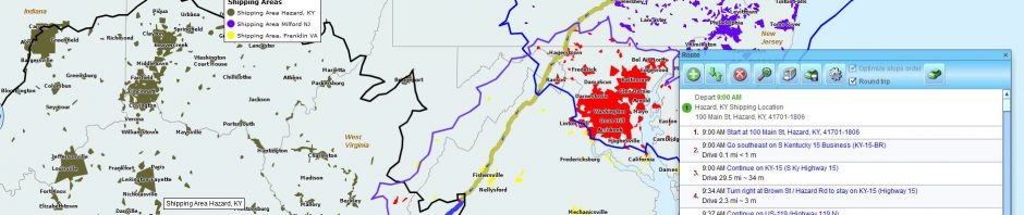
Using Drive Time Visualizations to Analyze Shipping
Government Agency
Sure, any decent size Government Agency may have access to a full-on GIS department dedicated to creating in-depth maps of agency doings. But they probably won’t prioritize your piddly business maps. It is a fact of life that GIS departments have a waiting list of maps to contend with and like many waiting lists, low-priority requirements get shuffled to the side.
So, Government Agencies, just like regular businesses turn to affordable and easy-to-use business mapping software to get the maps they need in short order.
In our experience, Government mapping requirements include a variety of challenges:
- Identifying municipal waste management drop-off and pick-up locations, both for public awareness and for operational review.
- Managing travel arrangements for Federal Employees. This is a big job and territory maps help to organize who purchases travel for what employees. Favored and approved hotels and restaurants are color-coded on business maps for easy reference. Maps are shared to keep all constituents updated on travel status.
- Education departments use business mapping to visualize student participation levels by school system and school buildings. Demographic analysis is included to help project future faculty and facility requirement by town or administrative district. And don’t forget bus routes. No school system map analysis is complete without a bus operation route, complete with pick-up and drop-off locations for all the kids in the district.
Government customers of Map Business Online are some of the most dedicated workers we speak with. Career employees with an eye on efficiency, they ride below the political radar keeping the business of government moving forward, in part by saying it with a business map.
Call Center Business
Whether you’re outbound calling to survey populations for political parties or simply picking up the phone to take orders for ShamWow!, your call center probably tracks your work on a business map.
Call Centers like to break incoming or outbound calling into territory segments. The geographic segmentation units or map layers will vary based on project or sell-type. Often call centers apply ZIP code maps. Each territory is assessed for demographic sales potential which helps to allocate appropriate people-power or call center reps to the project.
Call centers often set-up call assignment shared business maps. These maps can ingest an inbound or outbound call’s ZIP code for map placement and territory assignment, helping to track call representative progress as they move through a list of targets. Shared business maps can also be used to balance incoming call response loads by area of responsibility.
The Traveling Salesperson
Salespeople work for companies, and sometimes the company decides which mapping tools or territory management software will be applied. Map Business Online is a great fit for a top-down, company driven sales territory tool, but it also works for lone-wolf traveling salespeople looking to better organize their days and weeks.
A typical lone-wolf traveling salesperson will use business mapping to do the following:
- Import and visualize all existing customers by location. In some cases, salespeople will adjust color coding based on visit recency. They can also track visits by date. Typically, salespeople will want to keep a running tally of sales dollars achieved by account, on a business map.
- Create and track their specific area of company responsibility on an accessible map view. This process allows the remote traveling salesperson to synch-up their understanding of territory accountability with their boss.
- Import and view all prospective accounts. Prospects are where your stretch goal achievement is going to come from. These future customers will be the accounts a salesperson will turn to when planned visits get canceled during your trip.
- Generate multi-stop routes that match call schedule requirements. Salespeople can route sales calls for travel efficiency or in an order that matches their unique in-the-field requirements.
No matter what industry you hail from you’ll find importing your location data into a business map will help you solve problems, improve efficiencies, or track progress. Join the crowd saying it with a rubber biscuit.
Just checking to see if you’re still reading. Say it with a business map!
Win a $20 Gift Card! Refer a business associate to Map Business Online in exchange for a $20 Amazon Gift Card!
Find out why over 25,000 business users log into www.MapBusinessOnline.com for their business mapping software and advanced sales territory mapping solution. The best replacement for Microsoft MapPoint happens to be the most affordable.
Contact: Geoffrey Ives geoffives@spatialteq.com or Jason Henderson jhenderson@spatialteq.com