Sales professionals use map-based customer tracking tools like MapBusinessOnline to monitor customer activity, plan sales trips, and expose geographic patterns from sales and customer data. MapBusinessOnline provides a set of twelve features and functions that enhance a salesperson’s ability to visualize their sales territory and effectively manage the customers and prospects distributed across their assigned areas.
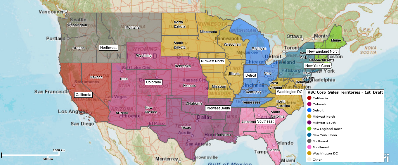
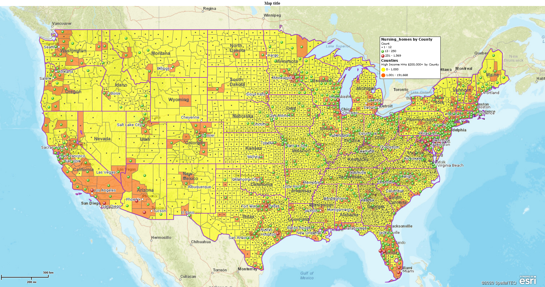
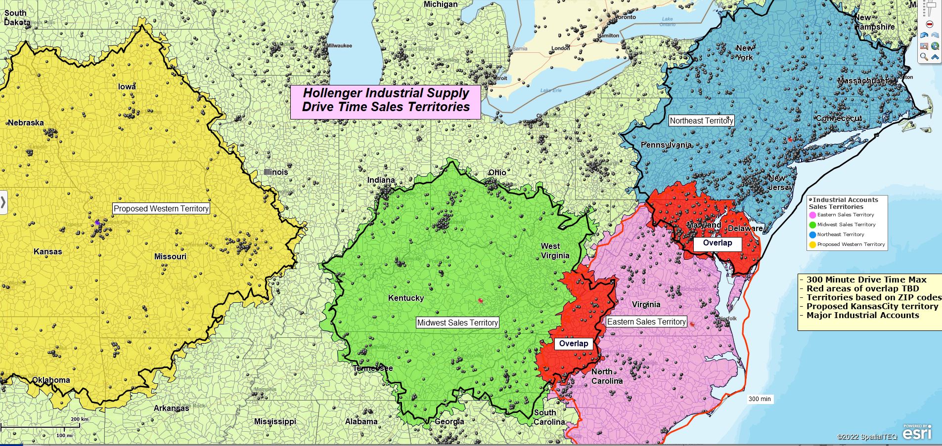
Nation-wide Sales Territory Mapping Developed Using MapBusinessOnline.
Those MapBusinessOnline functions that specifically address sales professionals include:
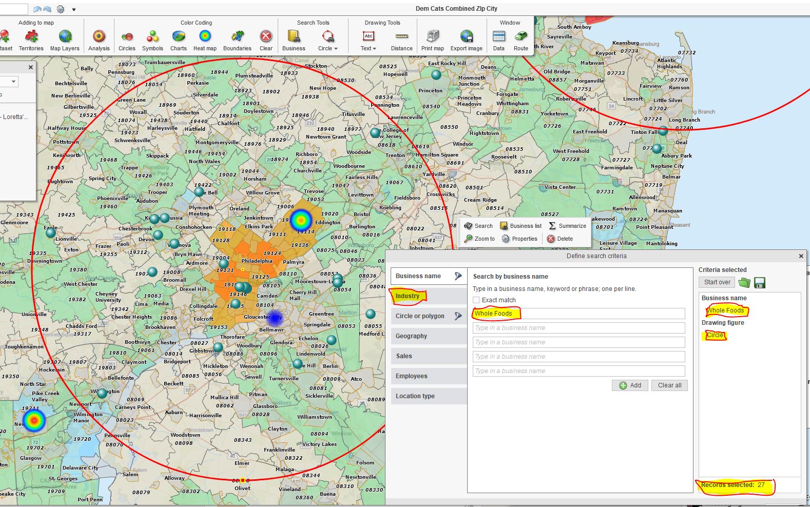
- Customer Map Visualizations – Import address spreadsheets of customers and prospects, color-coded for fast identification. Arrange and symbolize your imported data to reflect sales revenue, visit dates, or other relevant data. Conduct spatial searches.
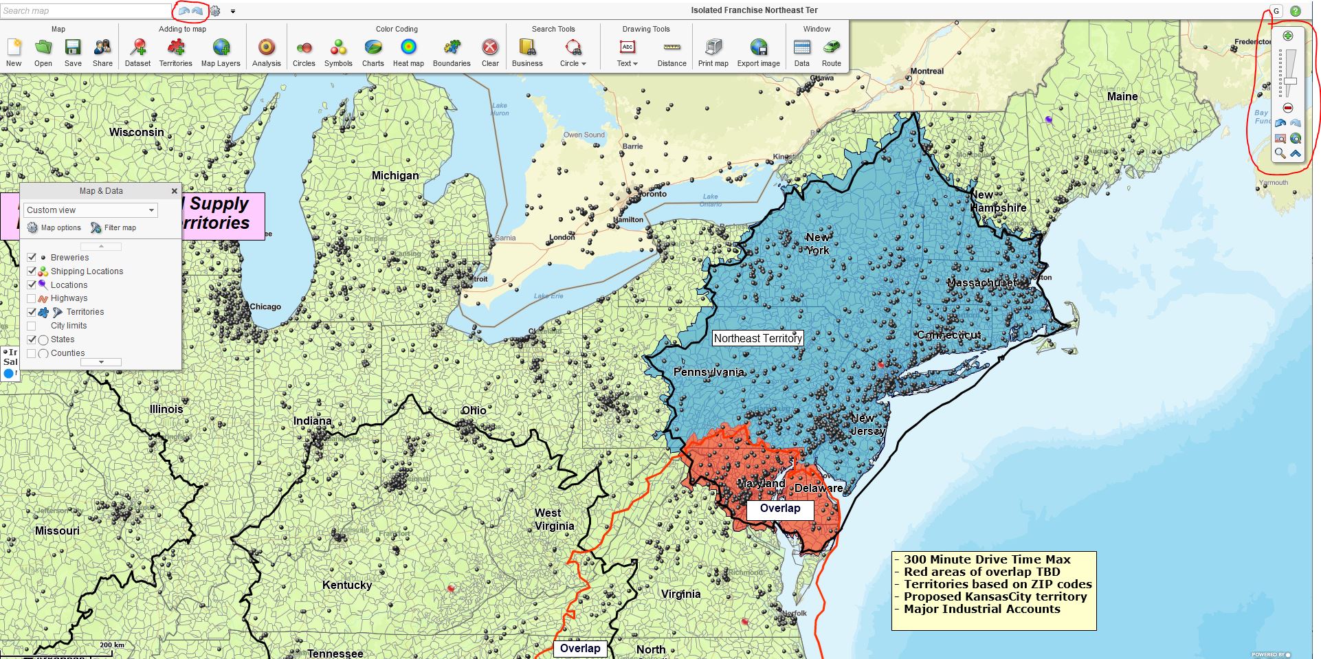
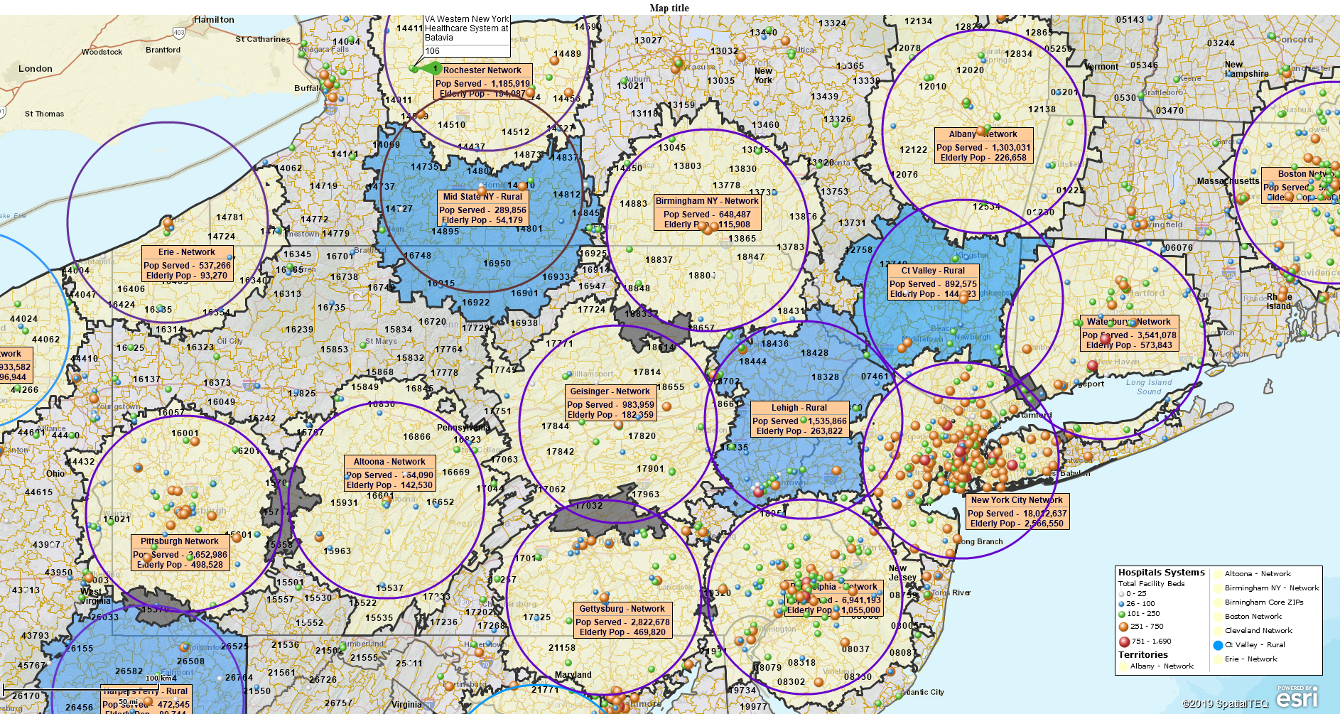
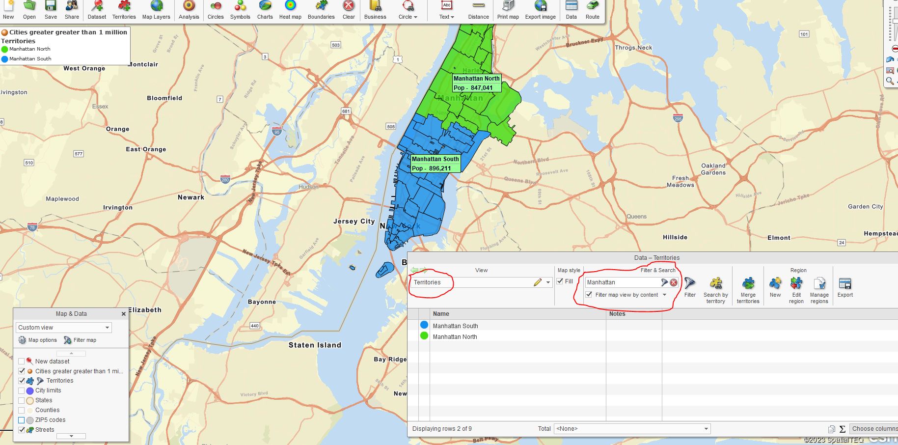
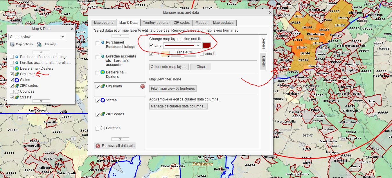
- Sales Territory Mapping – Shared or individually created territories that define a salesperson’s area of accountability, focusing their activities on company goals and objectives. Import territory spreadsheets or create territories from scratch using ZIP Codes, City Limits, Counties, or States.
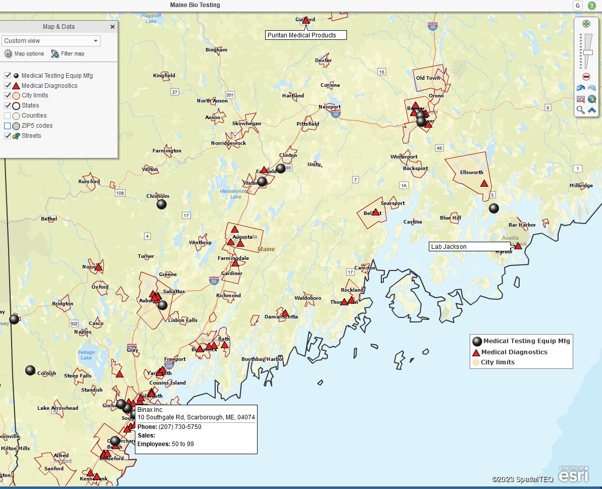
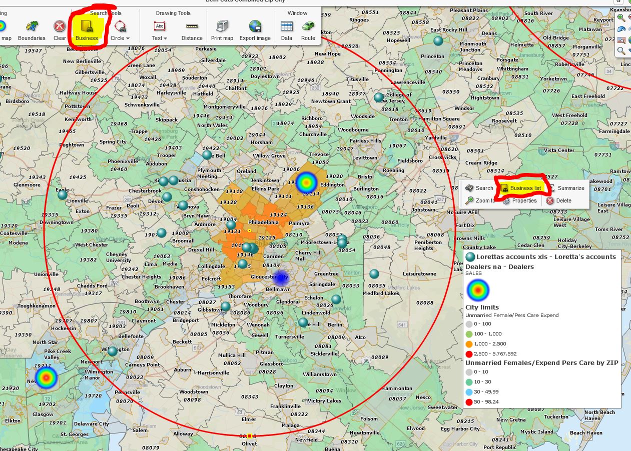
- Business Listing Searches – Identify, access, and plot prospective customers or competing businesses. MapBusinessOnline business listings include firmographics and critical contact information.
- Optimized Vehicle Routing – Create optimized routes for salespeople traveling from home or office to as many as 150 stops. Supports round trips or one-ways, time windows, and provides time and mileage estimates. Routes are exportable as GPX or CSV files and easily opened from
within Excel. - Market Analysis – Compare actual sales activity to sales potential. Build ZIP codes profiles from actual sales results and demographic analysis for sales expansion planning. Find the USA cities that best match your product’s demographic sweet spot.
- Estimate Sales Team Travel Expenses – Conduct driving time and distance analysis from start-of-day locations to customer lists. Great for any mobile support team.
- Shared Sales Objectives & Progress Against Goals – MapBusinessOnline sales territory mapping tools are a great way to present sales results in a sales meeting or through online shared maps. Conduct a live session or let salespeople view the results on their own time.
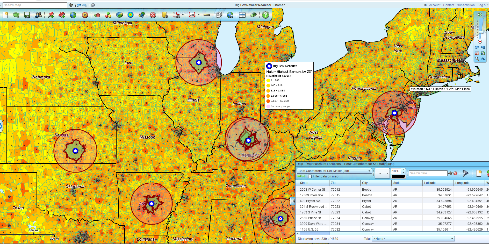
- Conduct Demographic Analysis – Overlay imported customer sales data over demographic heat maps of your business’s areas of interest—append labels with demographic data or export demographic information.
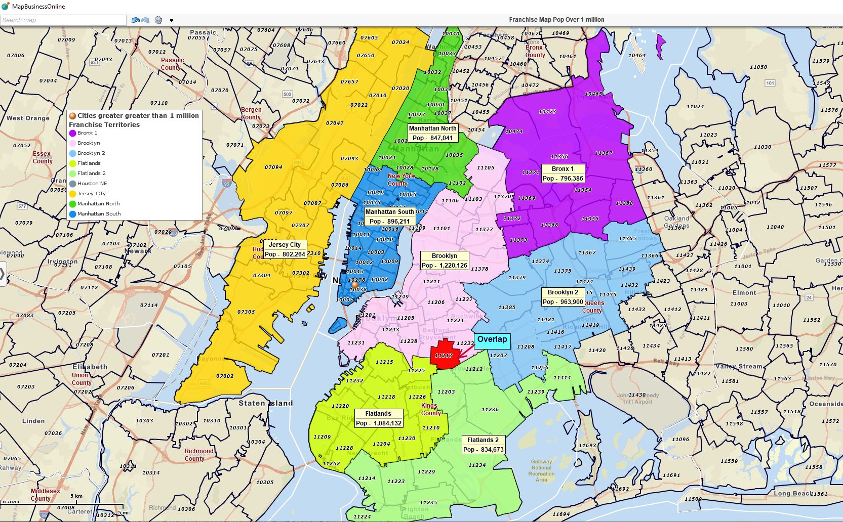
- Franchise Territory Maps – Easy-to-use sales territory maps are perfect for franchise organizations. Use sales territories as marketing collateral. Develop franchise territory segmentation based on demographics or other criteria. Attach maps and datasheets to franchise ownership documentation.
- Sales Tracking Platform – Business map users often become so used to geographic visualizations of customers and prospects that MapBusinessOnline becomes their defacto CRM tool. Establish individual maps by region to cover specific customers with specific driving times. This sort of customer territory view is especially helpful to salespeople who frequently travel for face-to-face meetings.
- Driving Time and Distance Querys – Driving time assessments help establish sales territory scope and inform logistics planning. Driving time zones are often used to develop delivery charges. MapBusinessOnline Pro includes advanced driving time and distance analysis.
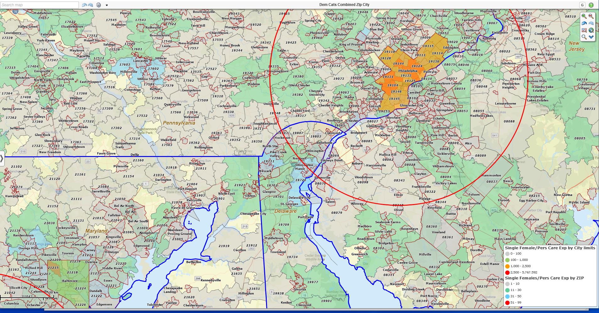
- Heat Mapping – Color-code your ZIP codes, counties, cities, or territories based on your sales numbers or sales and marketing activity.
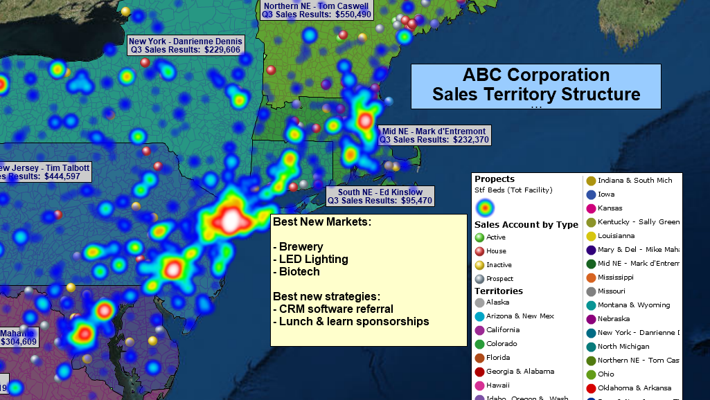
A Sales Organization Map Visualization.
MapBusinessOnline Standard provides all the essential sales-related business mapping tools for sales planning, logistics, and territory management. Consider MapBusinessOnline Pro for advanced market analysis, driving time and distance queries across multiple center points and multiple datasets.
- MapBusinessOnline Pro provides the most significant location data import allowance – up to 250,000 records. (Standard – 50,000.)
- MapBusinessOnline Pro allows up to 1000 territories. (Standard – 50.)
- MapBusinessOnline Pro includes all the functionality of MapBusinessOnline Standard.
Finally, replace that tattered copy of Microsoft MapPoint. What company that you respect uses ten-year-old software? Get with the cloud program…
MapBusinessOnline – Affordable yet advanced business mapping tools – designed to maximize your business benefit from geographic analysis and map visualizations without requiring degreed experts, consultants, or new bodies. (We hate those guys.)
Contact MapBusinessOnline for a web demo today.
_______________________________________________
Discover why over 25,000 business users log into www.MapBusinessOnline.com for their business mapping software and advanced sales territory mapping solution. The best replacement for Microsoft MapPoint happens to be the most affordable.
To access MapBusinessOnline, please register and download the Map App from the website – https://www.mapbusinessonline.com/App-Download.aspx.
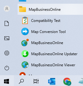
After installing the Map App, the MapBusinessOnline launch button will be in the Windows Start Menu or Mac Application folder. Find the MapBusinessOnline folder in the Start Menu scrollbar. Click the folder’s dropdown arrow and choose the MapBusinessOnline option.
The Map App includes the Map Viewer app for free non-subscriber map sharing.
Please read customer reviews or review us at Capterra or g2crowd.
Contact: Geoffrey Ives at geoffives@spatialteq.com or Jason Henderson at jhenderson@spatialteq.com.